Bolands geodata
Bolands (Saint Mary) is a seat of a first-order administrative division; located in Antigua and Barbuda in America/Antigua (GMT-4) time zone. With population of 1,657 people, there are 4 cities with bigger population in this country. Compared to other cities in Antigua and Barbuda, 57.1% of cities are located further ↑North; 100% of cities are located further →East and 57.1% of cities have lower elevation than Bolands. Note1


Bolands GPS coordinates[2]
17° 3' 56.34" North, 61° 52' 28.776" West
| Map corner | latitude | longitude |
|---|---|---|
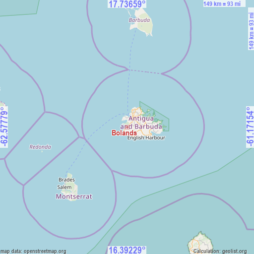
| Upper-left | 17.73659°, | -62.57779° |
| Center: | 17.06565°, | -61.87466° |
| Lower-right: | 16.39229°, | -61.17154° |
| Map W x H: | 149.5×149.5 km | = 92.9×92.9mi |
| max Lat: | 17.63333° ⇑57.1% North |
| Bolands: | 17.06565° |
| min Lat: | ⇓42.9% South 17.01637° |
| min Long | Bolands | max Long |
| -61.87466° | -61.87466° | -61.70332° |
| W 0%⇐ | ⇒100% E |
Elevation
Elevation of Bolands is 9 m = 30 ft, and this is 1.9 m = 6 ft below average elevation for this country.
| Max E: |
60 m = 197 ft | 42.9% |
| Avg. | 10.9 m = 36 ft | |
| Bolands | 9 m = 30 ft | |
Min E: |
1 m = 3 ft | 57.1% |
See also: Antigua and Barbuda elevation on elevation.city.
Geographical zone
Bolands is located in North Torrid zone (between Equator and Tropic of Cancer). Distance of this Northern Tropic circle is 708.4 km =440.2 mi to North.| Distance of | km | miles | from Bolands |
|---|---|---|---|
| North Pole | 8109.5 | 5039 | to North |
| Arctic Circle | 5503.7 | 3419.8 | to North |
| Tropic Cancer | 708.4 | 440.2 | to North |
| Equator | 1897.5 | 1179.1 | to South |


Nearby cities:
14 places around Bolands: (largest is in red/bold)
• All Saints
8.7 km =5.4 mi,  89°
89°
• Carlisle
10.6 km =6.6 mi,  45°
45°
• Cedar Grove
12.3 km =7.6 mi,  29°
29°
• Codrington
63.3 km =39.3 mi,  3°
3°
• English Harbour Town
12.7 km =7.9 mi,  115°
115°
• Falmouth
10.8 km =6.7 mi,  113°
113°
• Freetown
18.3 km =11.4 mi,  96°
96°
• Liberta
9.3 km =5.8 mi, 106°
• Old Road
6.8 km =4.2 mi,  142°
142°
• Parham
11.6 km =7.2 mi,  72°
72°
• Piggotts
9.8 km =6.1 mi, 54°
• Potters Village
7.9 km =4.9 mi, 47°
• Saint John’s
7 km =4.3 mi, 28°
• Swetes
8 km =5 mi, 102°
Sources, notices
• [Note1] Compared only with cities in Antigua and Barbuda existing in our database
• [Src1] Map data: © OpenStreetMap contributors (CC-BY-SA)
• [Src2] Other city data from geonames.org with taken over terms of usage.
• [Src3] Geographical zone / Annual Mean Temperature by Robert A. Rohde @ Wikipedia
