San Pedro geodata
San Pedro (Santiago del Estero) is a seat of a second-order administrative division; located in Argentina in America/Argentina/Catamarca (GMT-3) time zone. With population of 1,715 people, there are 670 cities with bigger population in this country. Compared to other cities in Argentina, 75.1% of cities are located further ↓South; 73.8% of cities are located further →East and 72.7% of cities have lower elevation than San Pedro. Note1


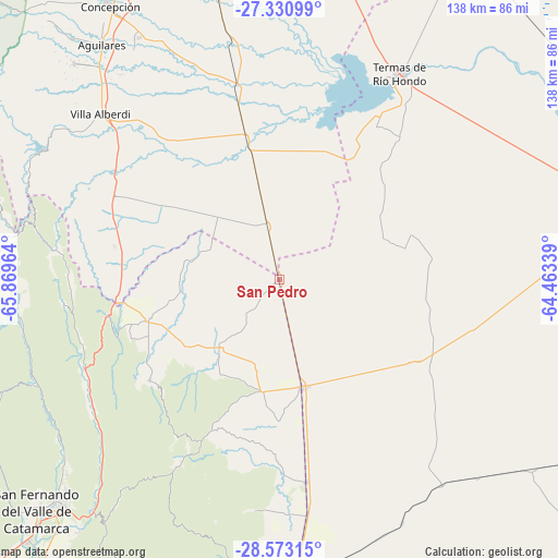
San Pedro GPS coordinates[2]
27° 57' 13.896" South, 65° 9' 59.436" West
| Map corner | latitude | longitude |
|---|---|---|
| Upper-left | -27.33099°, | -65.86964° |
| Center: | -27.95386°, | -65.16651° |
| Lower-right: | -28.57315°, | -64.46339° |
| Map W x H: | 138.1×138.1 km | = 85.8×85.8mi |
| max Lat: | -21.94467° ⇑24.9% North |
| San Pedro: | -27.95386° |
| min Lat: | ⇓75.1% South -54.81084° |
| min Long | San Pedro | max Long |
| -72.88605° | -65.16651° | -53.64581° |
| W 26.2%⇐ | ⇒73.8% E |
Elevation
Elevation of San Pedro is 382 m = 1253 ft, and this is 32.7 m = 107 ft above average elevation for this country.
| Max E: |
4040 m = 13255 ft | 27.3% |
| San Pedro | 382 m 1253 ft | |
| Avg. | 349.3 m = 1146 ft | |
Min E: |
-2 m = -7 ft | 72.7% |
See also: Argentina elevation on elevation.city.
Geographical zone
San Pedro is located in South temperate zone (between Tropic of Capricorn and the Antarctic Circle). Distance of this Southern Tropic circle is 502.3 km =312.1 mi to North.| Distance of | km | miles | from San Pedro |
|---|---|---|---|
| Equator | 3108.2 | 1931.3 | to North |
| Tropic Capricorn | 502.3 | 312.1 | to North |
| Antarctic Circle | 4293 | 2667.5 | to South |
| South Pole | 6898.9 | 4286.8 | to South |


Nearby cities:
15 places around San Pedro: (largest is in red/bold)
• Aguilares
72.7 km =45.2 mi,  322°
322°
• Bañado de Ovanta
22.5 km =14 mi,  221°
221°
• El Alto
44.2 km =27.5 mi,  205°
205°
• El Rodeo
75.3 km =46.8 mi,  247°
247°
• El Simbolar
26.7 km =16.6 mi,  94°
94°
• Frías
75.9 km =47.2 mi,  177°
177°
• Graneros
43.1 km =26.8 mi, 321°
• La Cocha
46.2 km =28.7 mi,  296°
296°
• La Merced
53.2 km =33.1 mi, 245°
• La Puerta
65.8 km =40.9 mi, 248°
• Los Altos
34.3 km =21.3 mi, 252°
• Los Varela
69.3 km =43.1 mi,  272°
272°
• San Antonio
53.6 km =33.3 mi,  263°
263°
• San José
70.8 km =44 mi,  227°
227°
• Termas de Río Hondo
59.4 km =36.9 mi,  30°
30°
Sources, notices
• [Note1] Compared only with cities in Argentina existing in our database
• [Src1] Map data: © OpenStreetMap contributors (CC-BY-SA)
• [Src2] Other city data from geonames.org with taken over terms of usage.
• [Src3] Geographical zone / Annual Mean Temperature by Robert A. Rohde @ Wikipedia
