Recreo geodata
Recreo (Catamarca) is a seat of a second-order administrative division; located in Argentina in America/Argentina/Catamarca (GMT-3) time zone. With population of 14,204 people, there are 236 cities with bigger population in this country. Compared to other cities in Argentina, 67.4% of cities are located further ↓South; 73.2% of cities are located further →East and 60.4% of cities have lower elevation than Recreo. Note1


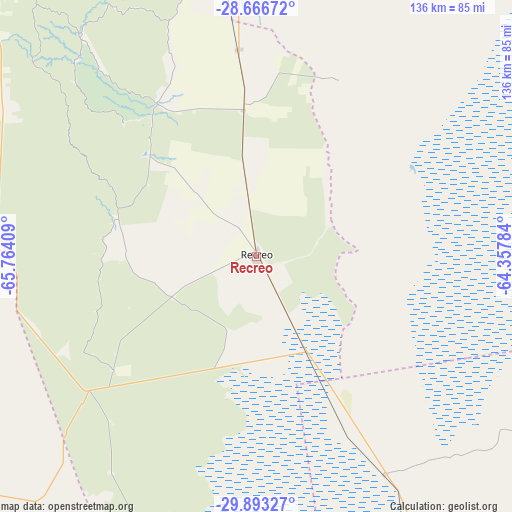
Recreo GPS coordinates[2]
29° 16' 54.624" South, 65° 3' 39.456" West
| Map corner | latitude | longitude |
|---|---|---|
| Upper-left | -28.66672°, | -65.76409° |
| Center: | -29.28184°, | -65.06096° |
| Lower-right: | -29.89327°, | -64.35784° |
| Map W x H: | 136.4×136.4 km | = 84.8×84.8mi |
| max Lat: | -21.94467° ⇑32.6% North |
| Recreo: | -29.28184° |
| min Lat: | ⇓67.4% South -54.81084° |
| min Long | Recreo | max Long |
| -72.88605° | -65.06096° | -53.64581° |
| W 26.8%⇐ | ⇒73.2% E |
Elevation
Elevation of Recreo is 216 m = 709 ft, and this is 133.3 m = 437 ft below average elevation for this country.
| Max E: |
4040 m = 13255 ft | 39.6% |
| Avg. | 349.3 m = 1146 ft | |
| Recreo | 216 m = 709 ft | |
Min E: |
-2 m = -7 ft | 60.4% |
See also: Argentina elevation on elevation.city.
Geographical zone
Recreo is located in South temperate zone (between Tropic of Capricorn and the Antarctic Circle). Distance of this Southern Tropic circle is 649.9 km =403.8 mi to North.| Distance of | km | miles | from Recreo |
|---|---|---|---|
| Equator | 3255.8 | 2023.1 | to North |
| Tropic Capricorn | 649.9 | 403.8 | to North |
| Antarctic Circle | 4145.3 | 2575.8 | to South |
| South Pole | 6751.2 | 4195 | to South |


Nearby cities:
15 places around Recreo: (largest is in red/bold)
• Ancasti
67.5 km =41.9 mi,  320°
320°
• Bañado de Ovanta
133.2 km =82.8 mi,  349°
349°
• Capayán
111.3 km =69.2 mi,  300°
300°
• Chumbicha
123.6 km =76.8 mi,  292°
292°
• El Alto
111.9 km =69.5 mi,  344°
344°
• Frías
72.1 km =44.8 mi, 354°
• Huillapima
108.6 km =67.5 mi, 304°
• Icaño
47.9 km =29.8 mi,  327°
327°
• La Merced
138.6 km =86.1 mi, 335°
• Quilino
116.9 km =72.6 mi,  152°
152°
• San Fernando del Valle de Catamarca
114.6 km =71.2 mi, 322°
• San Francisco del Chañar
121.8 km =75.7 mi,  117°
117°
• San Isidro
111.7 km =69.4 mi, 324°
• San José
117.7 km =73.1 mi, 328°
• Villa Ojo de Agua
134.7 km =83.7 mi,  100°
100°
Sources, notices
• [Note1] Compared only with cities in Argentina existing in our database
• [Src1] Map data: © OpenStreetMap contributors (CC-BY-SA)
• [Src2] Other city data from geonames.org with taken over terms of usage.
• [Src3] Geographical zone / Annual Mean Temperature by Robert A. Rohde @ Wikipedia
