Los Frentones geodata
Los Frentones (Chaco) is a populated place; located in Argentina in America/Argentina/Cordoba (GMT-3) time zone. With population of 6,610 people, there are 381 cities with bigger population in this country. Compared to other cities in Argentina, 90.9% of cities are located further ↓South; 58.2% of cities are located further ←West and 51.3% of cities have higher elevation than Los Frentones. Note1


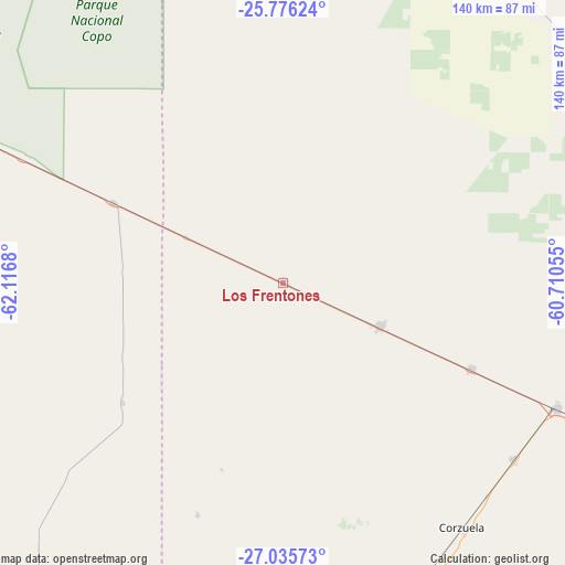
Los Frentones GPS coordinates[2]
26° 24' 27.72" South, 61° 24' 49.212" West
| Map corner | latitude | longitude |
|---|---|---|
| Upper-left | -25.77624°, | -62.1168° |
| Center: | -26.4077°, | -61.41367° |
| Lower-right: | -27.03573°, | -60.71055° |
| Map W x H: | 140×140 km | = 87×87mi |
| max Lat: | -21.94467° ⇑9.1% North |
| Los Frentones: | -26.4077° |
| min Lat: | ⇓90.9% South -54.81084° |
| min Long | Los Frentones | max Long |
| -72.88605° | -61.41367° | -53.64581° |
| W 58.2%⇐ | ⇒41.8% E |
Elevation
Elevation of Los Frentones is 136 m = 446 ft, and this is 213.3 m = 700 ft below average elevation for this country.
| Max E: |
4040 m = 13255 ft | 51.3% |
| Avg. | 349.3 m = 1146 ft | |
| Los Frentones | 136 m = 446 ft | |
Min E: |
-2 m = -7 ft | 48.7% |
See also: Argentina elevation on elevation.city.
Geographical zone
Los Frentones is located in South temperate zone (between Tropic of Capricorn and the Antarctic Circle). Distance of this Southern Tropic circle is 330.3 km =205.2 mi to North.| Distance of | km | miles | from Los Frentones |
|---|---|---|---|
| Equator | 2936.3 | 1824.5 | to North |
| Tropic Capricorn | 330.3 | 205.2 | to North |
| Antarctic Circle | 4464.9 | 2774.4 | to South |
| South Pole | 7070.8 | 4393.6 | to South |


Nearby cities:
15 places around Los Frentones: (largest is in red/bold)
• Aviá Terai
74.8 km =46.5 mi,  114°
114°
• Campo Largo
71.7 km =44.6 mi,  127°
127°
• Castelli
94.4 km =58.7 mi,  57°
57°
• Charata
92.4 km =57.4 mi,  165°
165°
• Concepción del Bermejo
51.2 km =31.8 mi, 114°
• Corzuela
75.1 km =46.7 mi,  143°
143°
• General Pinedo
101.9 km =63.3 mi, 172°
• La Clotilde
109.6 km =68.1 mi, 137°
• La Tigra
113.3 km =70.4 mi, 133°
• Las Breñas
82.7 km =51.4 mi,  156°
156°
• Napenay
87.1 km =54.1 mi, 114°
• Pampa de los Guanacos
46.7 km =29 mi,  295°
295°
• Pampa del Infierno
26.2 km =16.3 mi, 114°
• Presidencia Roque Sáenz Peña
105.6 km =65.6 mi, 113°
• Tres Isletas
98.1 km =61 mi,  85°
85°
Sources, notices
• [Note1] Compared only with cities in Argentina existing in our database
• [Src1] Map data: © OpenStreetMap contributors (CC-BY-SA)
• [Src2] Other city data from geonames.org with taken over terms of usage.
• [Src3] Geographical zone / Annual Mean Temperature by Robert A. Rohde @ Wikipedia
