La Clotilde geodata
La Clotilde (Chaco) is a populated place; located in Argentina in America/Argentina/Cordoba (GMT-3) time zone. With population of 3,625 people, there are 514 cities with bigger population in this country. Compared to other cities in Argentina, 85.1% of cities are located further ↓South; 63.3% of cities are located further ←West and 64.7% of cities have higher elevation than La Clotilde. Note1


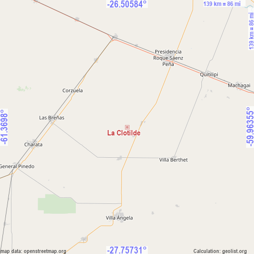
La Clotilde GPS coordinates[2]
27° 7' 59.988" South, 60° 40' 0.012" West
| Map corner | latitude | longitude |
|---|---|---|
| Upper-left | -26.50584°, | -61.3698° |
| Center: | -27.13333°, | -60.66667° |
| Lower-right: | -27.75731°, | -59.96355° |
| Map W x H: | 139.2×139.2 km | = 86.5×86.5mi |
| max Lat: | -21.94467° ⇑14.9% North |
| La Clotilde: | -27.13333° |
| min Lat: | ⇓85.1% South -54.81084° |
| min Long | La Clotilde | max Long |
| -72.88605° | -60.66667° | -53.64581° |
| W 63.3%⇐ | ⇒36.7% E |
Elevation
Elevation of La Clotilde is 94 m = 308 ft, and this is 255.3 m = 838 ft below average elevation for this country.
| Max E: |
4040 m = 13255 ft | 64.7% |
| Avg. | 349.3 m = 1146 ft | |
| La Clotilde | 94 m = 308 ft | |
Min E: |
-2 m = -7 ft | 35.3% |
See also: Argentina elevation on elevation.city.
Geographical zone
La Clotilde is located in South temperate zone (between Tropic of Capricorn and the Antarctic Circle). Distance of this Southern Tropic circle is 411 km =255.4 mi to North.| Distance of | km | miles | from La Clotilde |
|---|---|---|---|
| Equator | 3016.9 | 1874.6 | to North |
| Tropic Capricorn | 411 | 255.4 | to North |
| Antarctic Circle | 4384.2 | 2724.2 | to South |
| South Pole | 6990.1 | 4343.4 | to South |


Nearby cities:
15 places around La Clotilde: (largest is in red/bold)
• Aviá Terai
50.2 km =31.2 mi,  352°
352°
• Campo Largo
40.9 km =25.4 mi,  334°
334°
• Charata
52.3 km =32.5 mi,  260°
260°
• Corzuela
36 km =22.4 mi,  303°
303°
• General Pinedo
64.3 km =40 mi,  251°
251°
• La Tigra
8.3 km =5.2 mi,  71°
71°
• Las Breñas
41.4 km =25.7 mi,  276°
276°
• Machagai
65.3 km =40.6 mi, 69°
• Napenay
44.8 km =27.8 mi,  6°
6°
• Presidencia Roque Sáenz Peña
44.8 km =27.8 mi,  30°
30°
• Quitilipi
53.4 km =33.2 mi,  56°
56°
• Samuhú
51 km =31.7 mi,  147°
147°
• San Bernardo
17.8 km =11.1 mi,  194°
194°
• Villa Berthet
30.7 km =19.1 mi,  125°
125°
• Villa Ángela
49.2 km =30.6 mi, 185°
Sources, notices
• [Note1] Compared only with cities in Argentina existing in our database
• [Src1] Map data: © OpenStreetMap contributors (CC-BY-SA)
• [Src2] Other city data from geonames.org with taken over terms of usage.
• [Src3] Geographical zone / Annual Mean Temperature by Robert A. Rohde @ Wikipedia
