Choele Choel geodata
Choele Choel (Rio Negro) is a seat of a second-order administrative division; located in Argentina in America/Argentina/Salta (GMT-3) time zone. With population of 9,791 people, there are 296 cities with bigger population in this country. Compared to other cities in Argentina, 93.2% of cities are located further ↑North; 79.4% of cities are located further →East and 52.4% of cities have higher elevation than Choele Choel. Note1


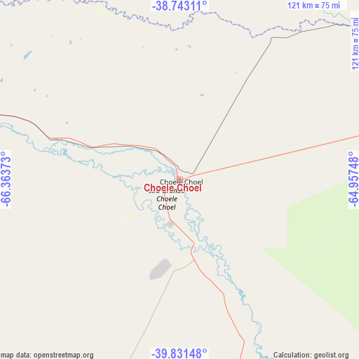
Choele Choel GPS coordinates[2]
39° 17' 21.876" South, 65° 39' 38.16" West
| Map corner | latitude | longitude |
|---|---|---|
| Upper-left | -38.74311°, | -66.36373° |
| Center: | -39.28941°, | -65.6606° |
| Lower-right: | -39.83148°, | -64.95748° |
| Map W x H: | 121×121 km | = 75.2×75.2mi |
| max Lat: | -21.94467° ⇑93.2% North |
| Choele Choel: | -39.28941° |
| min Lat: | ⇓6.8% South -54.81084° |
| min Long | Choele Choel | max Long |
| -72.88605° | -65.6606° | -53.64581° |
| W 20.6%⇐ | ⇒79.4% E |
Elevation
Elevation of Choele Choel is 131 m = 430 ft, and this is 218.3 m = 716 ft below average elevation for this country.
| Max E: |
4040 m = 13255 ft | 52.4% |
| Avg. | 349.3 m = 1146 ft | |
| Choele Choel | 131 m = 430 ft | |
Min E: |
-2 m = -7 ft | 47.6% |
See also: Argentina elevation on elevation.city.
Geographical zone
Choele Choel is located in South temperate zone (between Tropic of Capricorn and the Antarctic Circle). Distance of this Southern Tropic circle is 1762.7 km =1095.3 mi to North.| Distance of | km | miles | from Choele Choel |
|---|---|---|---|
| Equator | 4368.6 | 2714.5 | to North |
| Tropic Capricorn | 1762.7 | 1095.3 | to North |
| Antarctic Circle | 3032.6 | 1884.4 | to South |
| South Pole | 5638.5 | 3503.6 | to South |


Nearby cities:
15 places around Choele Choel: (largest is in red/bold)
• Chichinales
110.8 km =68.8 mi,  280°
280°
• Chimpay
43.7 km =27.2 mi,  288°
288°
• Coronel Belisle
27.7 km =17.2 mi, 294°
• Cuchillo Có
138.1 km =85.8 mi,  39°
39°
• Darwin
11.7 km =7.3 mi,  324°
324°
• Fray Luis Beltrán
9 km =5.6 mi,  252°
252°
• General Conesa
137.2 km =85.3 mi,  131°
131°
• General Enrique Godoy
131.2 km =81.5 mi, 280°
• Ingeniero Luis A. Huergo
138.1 km =85.8 mi, 280°
• La Adela
140.2 km =87.1 mi,  75°
75°
• Lamarque
15.3 km =9.5 mi,  193°
193°
• Mainque
143.5 km =89.2 mi, 279°
• Puelches
129.1 km =80.2 mi,  350°
350°
• Río Colorado
139.1 km =86.4 mi, 76°
• Villa Regina
123 km =76.4 mi, 279°
Sources, notices
• [Note1] Compared only with cities in Argentina existing in our database
• [Src1] Map data: © OpenStreetMap contributors (CC-BY-SA)
• [Src2] Other city data from geonames.org with taken over terms of usage.
• [Src3] Geographical zone / Annual Mean Temperature by Robert A. Rohde @ Wikipedia
