Cervantes geodata
Cervantes (Rio Negro) is a populated place; located in Argentina in America/Argentina/Salta (GMT-3) time zone. With population of 5,173 people, there are 439 cities with bigger population in this country. Compared to other cities in Argentina, 92.2% of cities are located further ↑North; 87.3% of cities are located further →East and 61.1% of cities have lower elevation than Cervantes. Note1


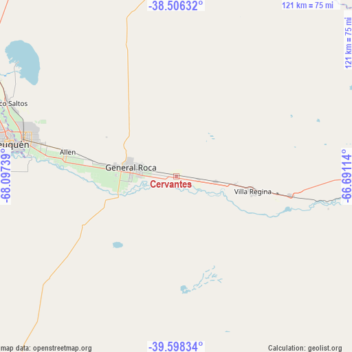
Cervantes GPS coordinates[2]
39° 3' 15.984" South, 67° 23' 39.336" West
| Map corner | latitude | longitude |
|---|---|---|
| Upper-left | -38.50632°, | -68.09739° |
| Center: | -39.05444°, | -67.39426° |
| Lower-right: | -39.59834°, | -66.69114° |
| Map W x H: | 121.4×121.4 km | = 75.4×75.4mi |
| max Lat: | -21.94467° ⇑92.2% North |
| Cervantes: | -39.05444° |
| min Lat: | ⇓7.8% South -54.81084° |
| min Long | Cervantes | max Long |
| -72.88605° | -67.39426° | -53.64581° |
| W 12.7%⇐ | ⇒87.3% E |
Elevation
Elevation of Cervantes is 222 m = 728 ft, and this is 127.3 m = 418 ft below average elevation for this country.
| Max E: |
4040 m = 13255 ft | 38.9% |
| Avg. | 349.3 m = 1146 ft | |
| Cervantes | 222 m = 728 ft | |
Min E: |
-2 m = -7 ft | 61.1% |
See also: Argentina elevation on elevation.city.
Geographical zone
Cervantes is located in South temperate zone (between Tropic of Capricorn and the Antarctic Circle). Distance of this Southern Tropic circle is 1736.5 km =1079 mi to North.| Distance of | km | miles | from Cervantes |
|---|---|---|---|
| Equator | 4342.4 | 2698.2 | to North |
| Tropic Capricorn | 1736.5 | 1079 | to North |
| Antarctic Circle | 3058.7 | 1900.6 | to South |
| South Pole | 5664.6 | 3519.8 | to South |


Nearby cities:
15 places around Cervantes: (largest is in red/bold)
• Allen
38.4 km =23.9 mi,  282°
282°
• Centenario
68.5 km =42.6 mi,  291°
291°
• Chichinales
40.9 km =25.4 mi,  99°
99°
• Cinco Saltos
63.3 km =39.3 mi, 294°
• Cipolletti
53.2 km =33.1 mi, 284°
• Contraalmirante Cordero
75.2 km =46.7 mi,  299°
299°
• General Enrique Godoy
20.6 km =12.8 mi, 97°
• General Fernández Oro
47.2 km =29.3 mi, 283°
• General Roca
16.5 km =10.3 mi, 278°
• Ingeniero Luis A. Huergo
13.6 km =8.5 mi, 97°
• Mainque
8.3 km =5.2 mi, 99°
• Neuquén
58.6 km =36.4 mi, 281°
• Plottier
73.1 km =45.4 mi, 277°
• Villa Regina
28.7 km =17.8 mi, 100°
• Vista Alegre
76.2 km =47.3 mi, 296°
Sources, notices
• [Note1] Compared only with cities in Argentina existing in our database
• [Src1] Map data: © OpenStreetMap contributors (CC-BY-SA)
• [Src2] Other city data from geonames.org with taken over terms of usage.
• [Src3] Geographical zone / Annual Mean Temperature by Robert A. Rohde @ Wikipedia
