Catriel geodata
Catriel (Rio Negro) is a populated place; located in Argentina in America/Argentina/Salta (GMT-3) time zone. With population of 15,169 people, there are 222 cities with bigger population in this country. Compared to other cities in Argentina, 88.3% of cities are located further ↑North; 89% of cities are located further →East and 68.5% of cities have lower elevation than Catriel. Note1


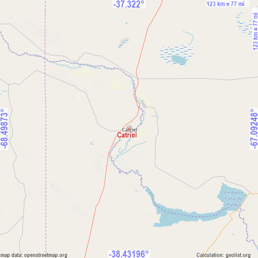
Catriel GPS coordinates[2]
37° 52' 44.652" South, 67° 47' 44.16" West
| Map corner | latitude | longitude |
|---|---|---|
| Upper-left | -37.322°, | -68.49873° |
| Center: | -37.87907°, | -67.7956° |
| Lower-right: | -38.43196°, | -67.09248° |
| Map W x H: | 123.4×123.4 km | = 76.7×76.7mi |
| max Lat: | -21.94467° ⇑88.3% North |
| Catriel: | -37.87907° |
| min Lat: | ⇓11.7% South -54.81084° |
| min Long | Catriel | max Long |
| -72.88605° | -67.7956° | -53.64581° |
| W 11%⇐ | ⇒89% E |
Elevation
Elevation of Catriel is 323 m = 1060 ft, and this is 26.3 m = 86 ft below average elevation for this country.
| Max E: |
4040 m = 13255 ft | 31.5% |
| Avg. | 349.3 m = 1146 ft | |
| Catriel | 323 m = 1060 ft | |
Min E: |
-2 m = -7 ft | 68.5% |
See also: Argentina elevation on elevation.city.
Geographical zone
Catriel is located in South temperate zone (between Tropic of Capricorn and the Antarctic Circle). Distance of this Southern Tropic circle is 1605.8 km =997.8 mi to North.| Distance of | km | miles | from Catriel |
|---|---|---|---|
| Equator | 4211.8 | 2617.1 | to North |
| Tropic Capricorn | 1605.8 | 997.8 | to North |
| Antarctic Circle | 3189.4 | 1981.8 | to South |
| South Pole | 5795.3 | 3601 | to South |


Nearby cities:
15 places around Catriel: (largest is in red/bold)
• Allen
122.1 km =75.9 mi,  181°
181°
• Añelo
101.7 km =63.2 mi,  238°
238°
• Centenario
109.7 km =68.2 mi,  195°
195°
• Cervantes
135.3 km =84.1 mi,  165°
165°
• Cinco Saltos
107.4 km =66.7 mi,  192°
192°
• Cipolletti
118.5 km =73.6 mi, 188°
• Contraalmirante Cordero
99 km =61.5 mi, 198°
• General Fernández Oro
119.9 km =74.5 mi, 185°
• General Roca
129.7 km =80.6 mi, 171°
• Limay Mahuida
127.2 km =79 mi,  51°
51°
• Neuquén
121.4 km =75.4 mi, 190°
• Plottier
126.8 km =78.8 mi, 197°
• Rincón de Los Sauces
113.2 km =70.3 mi,  298°
298°
• Veinticinco de Mayo
13.6 km =8.5 mi,  30°
30°
• Vista Alegre
102.6 km =63.8 mi, 199°
Sources, notices
• [Note1] Compared only with cities in Argentina existing in our database
• [Src1] Map data: © OpenStreetMap contributors (CC-BY-SA)
• [Src2] Other city data from geonames.org with taken over terms of usage.
• [Src3] Geographical zone / Annual Mean Temperature by Robert A. Rohde @ Wikipedia
