Wilfleinsdorf geodata
Wilfleinsdorf (Lower Austria) is a populated place; located in Austria in Europe/Vienna (GMT+2) time zone. With population of 1,106 people, there are 1155 cities with bigger population in this country. Compared to other cities in Austria, 67.2% of cities are located further ↓South; 97.5% of cities are located further ←West and 97.8% of cities have higher elevation than Wilfleinsdorf. Note1
Administrative division(s):
- Level 1: Lower Austria
- Level 2: Politischer Bezirk Bruck an der Leitha
- Level 3: Bruck an der Leitha


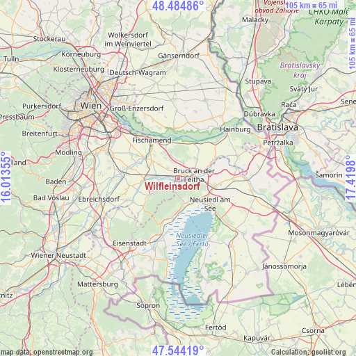
Wilfleinsdorf GPS coordinates[2]
48° 1' 0.012" North, 16° 43' 0.012" East
| Map corner | latitude | longitude |
|---|---|---|
| Upper-left | 48.48486°, | 16.01355° |
| Center: | 48.01667°, | 16.71667° |
| Lower-right: | 47.54419°, | 17.4198° |
| Map W x H: | 104.6×104.6 km | = 65×65mi |
| max Lat: | 48.98333° ⇑32.8% North |
| Wilfleinsdorf: | 48.01667° |
| min Lat: | ⇓67.2% South 46.48841° |
| min Long | Wilfleinsdorf | max Long |
| 9.57802° | 16.71667° | 17.1° |
| W 97.5%⇐ | ⇒2.5% E |
Elevation
Elevation of Wilfleinsdorf is 156 m = 512 ft, and this is 349.5 m = 1147 ft below average elevation for this country.
| Max E: |
2140 m = 7021 ft | 97.8% |
| Avg. | 505.5 m = 1658 ft | |
| Wilfleinsdorf | 156 m = 512 ft | |
Min E: |
118 m = 387 ft | 2.2% |
See also: Austria elevation on elevation.city.
Geographical zone
Wilfleinsdorf is located in North temperate zone (between Tropic of Cancer and the Arctic Circle). Distance of this North polar circle is 2062.2 km =1281.4 mi to North.| Distance of | km | miles | from Wilfleinsdorf |
|---|---|---|---|
| North Pole | 4668.1 | 2900.6 | to North |
| Arctic Circle | 2062.2 | 1281.4 | to North |
| Tropic Cancer | 2733 | 1698.2 | to South |
| Equator | 5339 | 3317.5 | to South |


Nearby cities:
15 places around Wilfleinsdorf: (largest is in red/bold)
• Arbesthal
5.7 km =3.5 mi,  347°
347°
• Breitenbrunn
8.1 km =5 mi,  172°
172°
• Bruck an der Leitha
3.7 km =2.3 mi,  90°
90°
• Bruckneudorf
5 km =3.1 mi, 90°
• Gallbrunn
7.2 km =4.5 mi,  300°
300°
• Göttlesbrunn
3.9 km =2.4 mi,  18°
18°
• Höflein
7.4 km =4.6 mi,  41°
41°
• Jois
8.5 km =5.3 mi,  136°
136°
• Margarethen am Moos
8.9 km =5.5 mi,  282°
282°
• Pachfurth
8.3 km =5.2 mi,  63°
63°
• Sarasdorf
2.9 km =1.8 mi, 279°
• Sommerein
6.2 km =3.9 mi,  233°
233°
• Stixneusiedl
4.2 km =2.6 mi, 296°
• Trautmannsdorf an der Leitha
6.3 km =3.9 mi, 277°
• Winden am See
7.8 km =4.8 mi,  161°
161°
Sources, notices
• [Note1] Compared only with cities in Austria existing in our database
• [Src1] Map data: © OpenStreetMap contributors (CC-BY-SA)
• [Src2] Other city data from geonames.org with taken over terms of usage.
• [Src3] Geographical zone / Annual Mean Temperature by Robert A. Rohde @ Wikipedia
