Sarasdorf geodata
Sarasdorf (Lower Austria) is a populated place; located in Austria in Europe/Vienna (GMT+2) time zone. With population of 605 people, there are 2121 cities with bigger population in this country. Compared to other cities in Austria, 67.8% of cities are located further ↓South; 97.2% of cities are located further ←West and 97.6% of cities have higher elevation than Sarasdorf. Note1
Administrative division(s):
- Level 1: Lower Austria
- Level 2: Politischer Bezirk Bruck an der Leitha
- Level 3: Trautmannsdorf an der Leitha


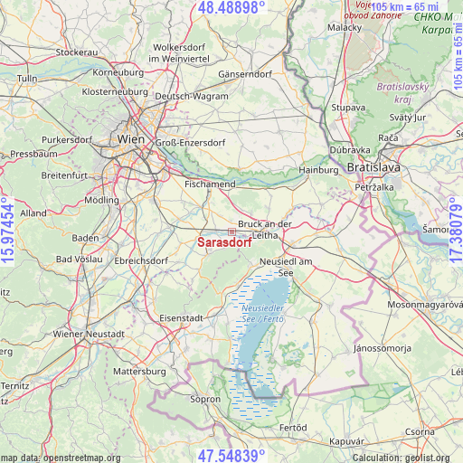
Sarasdorf GPS coordinates[2]
48° 1' 14.988" North, 16° 40' 39.576" East
| Map corner | latitude | longitude |
|---|---|---|
| Upper-left | 48.48898°, | 15.97454° |
| Center: | 48.02083°, | 16.67766° |
| Lower-right: | 47.54839°, | 17.38079° |
| Map W x H: | 104.6×104.6 km | = 65×65mi |
| max Lat: | 48.98333° ⇑32.2% North |
| Sarasdorf: | 48.02083° |
| min Lat: | ⇓67.8% South 46.48841° |
| min Long | Sarasdorf | max Long |
| 9.57802° | 16.67766° | 17.1° |
| W 97.2%⇐ | ⇒2.8% E |
Elevation
Elevation of Sarasdorf is 158 m = 518 ft, and this is 347.5 m = 1140 ft below average elevation for this country.
| Max E: |
2140 m = 7021 ft | 97.6% |
| Avg. | 505.5 m = 1658 ft | |
| Sarasdorf | 158 m = 518 ft | |
Min E: |
118 m = 387 ft | 2.4% |
See also: Austria elevation on elevation.city.
Geographical zone
Sarasdorf is located in North temperate zone (between Tropic of Cancer and the Arctic Circle). Distance of this North polar circle is 2061.8 km =1281.1 mi to North.| Distance of | km | miles | from Sarasdorf |
|---|---|---|---|
| North Pole | 4667.6 | 2900.3 | to North |
| Arctic Circle | 2061.8 | 1281.1 | to North |
| Tropic Cancer | 2733.5 | 1698.5 | to South |
| Equator | 5339.4 | 3317.7 | to South |


Nearby cities:
15 places around Sarasdorf: (largest is in red/bold)
• Arbesthal
5.4 km =3.4 mi,  18°
18°
• Bruck an der Leitha
6.6 km =4.1 mi,  93°
93°
• Bruckneudorf
7.9 km =4.9 mi, 93°
• Enzersdorf an der Fischa
8.8 km =5.5 mi,  324°
324°
• Gallbrunn
4.6 km =2.9 mi,  314°
314°
• Göttlesbrunn
5.3 km =3.3 mi,  51°
51°
• Götzendorf an der Leitha
7 km =4.3 mi,  266°
266°
• Mannersdorf am Leithagebirge
8.3 km =5.2 mi,  223°
223°
• Margarethen am Moos
5.9 km =3.7 mi,  283°
283°
• Maria Ellend
8.8 km =5.5 mi,  2°
2°
• Pischelsdorf
8.6 km =5.3 mi,  254°
254°
• Sommerein
4.6 km =2.9 mi,  206°
206°
• Stixneusiedl
1.6 km =1 mi,  329°
329°
• Trautmannsdorf an der Leitha
3.4 km =2.1 mi, 275°
• Wilfleinsdorf
2.9 km =1.8 mi,  99°
99°
Sources, notices
• [Note1] Compared only with cities in Austria existing in our database
• [Src1] Map data: © OpenStreetMap contributors (CC-BY-SA)
• [Src2] Other city data from geonames.org with taken over terms of usage.
• [Src3] Geographical zone / Annual Mean Temperature by Robert A. Rohde @ Wikipedia
