Wartberg geodata
Wartberg (Styria) is a populated place; located in Austria in Europe/Vienna (GMT+2) time zone. With population of 1,958 people, there are 625 cities with bigger population in this country. Compared to other cities in Austria, 52.6% of cities are located further ↑North; 64.9% of cities are located further ←West and 68.9% of cities have lower elevation than Wartberg. Note1
Administrative division(s):
- Level 1: Styria
- Level 2: Politischer Bezirk Bruck-Mürzzuschlag
- Level 3: Sankt Barbara im Mürztal


Wartberg GPS coordinates[2]
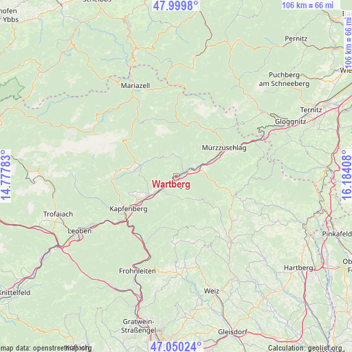
47° 31' 37.812" North, 15° 28' 51.42" East
| Map corner | latitude | longitude |
|---|---|---|
| Upper-left | 47.9998°, | 14.77783° |
| Center: | 47.52717°, | 15.48095° |
| Lower-right: | 47.05024°, | 16.18408° |
| Map W x H: | 105.6×105.6 km | = 65.6×65.6mi |
| max Lat: | 48.98333° ⇑52.6% North |
| Wartberg: | 47.52717° |
| min Lat: | ⇓47.4% South 46.48841° |
| min Long | Wartberg | max Long |
| 9.57802° | 15.48095° | 17.1° |
| W 64.9%⇐ | ⇒35.1% E |
Elevation
Elevation of Wartberg is 579 m = 1900 ft, and this is 73.5 m = 241 ft above average elevation for this country.
| Max E: |
2140 m = 7021 ft | 31.1% |
| Wartberg | 579 m 1900 ft | |
| Avg. | 505.5 m = 1658 ft | |
Min E: |
118 m = 387 ft | 68.9% |
See also: Austria elevation on elevation.city.
Geographical zone
Wartberg is located in North temperate zone (between Tropic of Cancer and the Arctic Circle). Distance of this North polar circle is 2116.6 km =1315.2 mi to North.| Distance of | km | miles | from Wartberg |
|---|---|---|---|
| North Pole | 4722.5 | 2934.4 | to North |
| Arctic Circle | 2116.6 | 1315.2 | to North |
| Tropic Cancer | 2678.6 | 1664.4 | to South |
| Equator | 5284.5 | 3283.6 | to South |


Nearby cities:
15 places around Wartberg: (largest is in red/bold)
• Allerheiligen im Mürztal
9.1 km =5.7 mi,  222°
222°
• Fressnitz
4.4 km =2.7 mi,  64°
64°
• Grossveitsch
6.8 km =4.2 mi,  354°
354°
• Kindberg
3.8 km =2.4 mi, 217°
• Krieglach
6.5 km =4 mi,  69°
69°
• Langenwang
11.1 km =6.9 mi, 66°
• Mitterdorf im Mürztal
2.8 km =1.7 mi,  75°
75°
• Mürzhofen
8.8 km =5.5 mi,  236°
236°
• Niederaigen
4.9 km =3 mi,  17°
17°
• Sankt Lorenzen im Mürztal
9.9 km =6.2 mi, 240°
• Sankt Marein im Mürztal
10.9 km =6.8 mi,  231°
231°
• Schaldorf
10.4 km =6.5 mi, 231°
• Sommer
5.9 km =3.7 mi,  41°
41°
• Turnau
11.3 km =7 mi,  287°
287°
• Veitsch
5.8 km =3.6 mi,  10°
10°
Sources, notices
• [Note1] Compared only with cities in Austria existing in our database
• [Src1] Map data: © OpenStreetMap contributors (CC-BY-SA)
• [Src2] Other city data from geonames.org with taken over terms of usage.
• [Src3] Geographical zone / Annual Mean Temperature by Robert A. Rohde @ Wikipedia
