Stams geodata
Stams (Tyrol) is a seat of a third-order administrative division; located in Austria in Europe/Vienna (GMT+2) time zone. With population of 1,495 people, there are 843 cities with bigger population in this country. Compared to other cities in Austria, 67.6% of cities are located further ↑North; 93.7% of cities are located further →East and 77.7% of cities have lower elevation than Stams. Note1


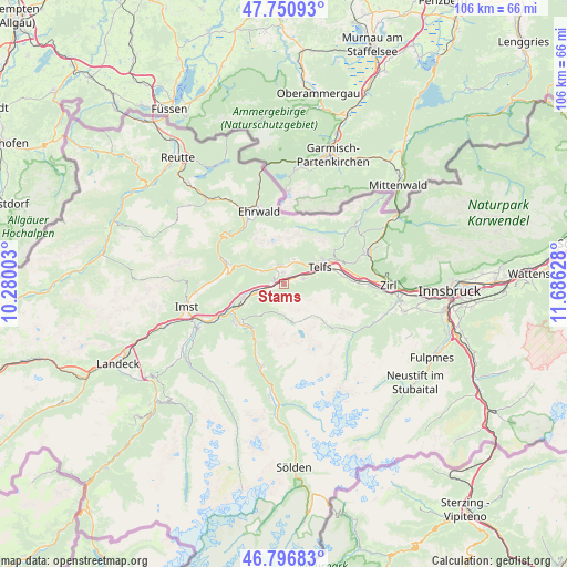
Stams GPS coordinates[2]
47° 16' 33.708" North, 10° 58' 59.34" East
| Map corner | latitude | longitude |
|---|---|---|
| Upper-left | 47.75093°, | 10.28003° |
| Center: | 47.27603°, | 10.98315° |
| Lower-right: | 46.79683°, | 11.68628° |
| Map W x H: | 106.1×106.1 km | = 65.9×65.9mi |
| max Lat: | 48.98333° ⇑67.6% North |
| Stams: | 47.27603° |
| min Lat: | ⇓32.4% South 46.48841° |
| min Long | Stams | max Long |
| 9.57802° | 10.98315° | 17.1° |
| W 6.3%⇐ | ⇒93.7% E |
Elevation
Elevation of Stams is 683 m = 2241 ft, and this is 177.5 m = 582 ft above average elevation for this country.
| Max E: |
2140 m = 7021 ft | 22.3% |
| Stams | 683 m 2241 ft | |
| Avg. | 505.5 m = 1658 ft | |
Min E: |
118 m = 387 ft | 77.7% |
See also: Austria elevation on elevation.city.
Geographical zone
Stams is located in North temperate zone (between Tropic of Cancer and the Arctic Circle). Distance of this North polar circle is 2144.6 km =1332.6 mi to North.| Distance of | km | miles | from Stams |
|---|---|---|---|
| North Pole | 4750.5 | 2951.8 | to North |
| Arctic Circle | 2144.6 | 1332.6 | to North |
| Tropic Cancer | 2650.7 | 1647.1 | to South |
| Equator | 5256.6 | 3266.3 | to South |


Nearby cities:
15 places around Stams: (largest is in red/bold)
• Barwies
2.9 km =1.8 mi,  334°
334°
• Haiming
8.1 km =5 mi,  248°
248°
• Mieming
2.7 km =1.7 mi,  0°
0°
• Mötz
2.6 km =1.6 mi,  287°
287°
• Oberhofen im Inntal
8 km =5 mi,  70°
70°
• Obermieming
2.7 km =1.7 mi, 0°
• Obsteig
4.6 km =2.9 mi,  305°
305°
• Oetz
10.5 km =6.5 mi,  216°
216°
• Pfaffenhofen
8 km =5 mi, 70°
• Rietz
3.8 km =2.4 mi, 72°
• See
2.9 km =1.8 mi, 334°
• Silz
3.9 km =2.4 mi, 254°
• Telfs
7.3 km =4.5 mi,  61°
61°
• Untermieming
2.1 km =1.3 mi,  353°
353°
• Wildermieming
5.2 km =3.2 mi,  29°
29°
Sources, notices
• [Note1] Compared only with cities in Austria existing in our database
• [Src1] Map data: © OpenStreetMap contributors (CC-BY-SA)
• [Src2] Other city data from geonames.org with taken over terms of usage.
• [Src3] Geographical zone / Annual Mean Temperature by Robert A. Rohde @ Wikipedia
