Seckau geodata
Seckau (Styria) is a seat of a third-order administrative division; located in Austria in Europe/Vienna (GMT+2) time zone. With population of 601 people, there are 2139 cities with bigger population in this country. Compared to other cities in Austria, 68.3% of cities are located further ↑North; 51% of cities are located further ←West and 88.2% of cities have lower elevation than Seckau. Note1


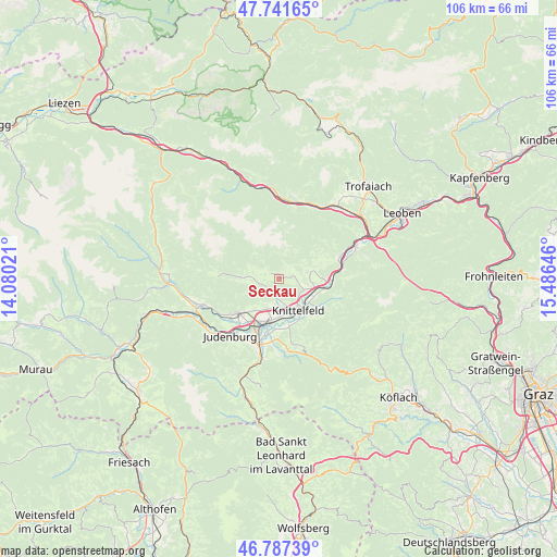
Seckau GPS coordinates[2]
47° 16' 0.012" North, 14° 46' 59.988" East
| Map corner | latitude | longitude |
|---|---|---|
| Upper-left | 47.74165°, | 14.08021° |
| Center: | 47.26667°, | 14.78333° |
| Lower-right: | 46.78739°, | 15.48646° |
| Map W x H: | 106.1×106.1 km | = 65.9×65.9mi |
| max Lat: | 48.98333° ⇑68.3% North |
| Seckau: | 47.26667° |
| min Lat: | ⇓31.7% South 46.48841° |
| min Long | Seckau | max Long |
| 9.57802° | 14.78333° | 17.1° |
| W 51%⇐ | ⇒49% E |
Elevation
Elevation of Seckau is 848 m = 2782 ft, and this is 342.5 m = 1124 ft above average elevation for this country.
| Max E: |
2140 m = 7021 ft | 11.8% |
| Seckau | 848 m 2782 ft | |
| Avg. | 505.5 m = 1658 ft | |
Min E: |
118 m = 387 ft | 88.2% |
See also: Austria elevation on elevation.city.
Geographical zone
Seckau is located in North temperate zone (between Tropic of Cancer and the Arctic Circle). Distance of this North polar circle is 2145.6 km =1333.2 mi to North.| Distance of | km | miles | from Seckau |
|---|---|---|---|
| North Pole | 4751.5 | 2952.4 | to North |
| Arctic Circle | 2145.6 | 1333.2 | to North |
| Tropic Cancer | 2649.6 | 1646.4 | to South |
| Equator | 5255.6 | 3265.7 | to South |


Nearby cities:
15 places around Seckau: (largest is in red/bold)
• Apfelberg
8.3 km =5.2 mi,  153°
153°
• Farrach
10 km =6.2 mi,  202°
202°
• Feistritz bei Knittelfeld
8.3 km =5.2 mi,  88°
88°
• Flatschach
6.1 km =3.8 mi, 204°
• Gaal
8.6 km =5.3 mi,  274°
274°
• Großlobming
9.4 km =5.8 mi,  172°
172°
• Knittelfeld
6.1 km =3.8 mi,  155°
155°
• Kobenz
5.4 km =3.4 mi,  110°
110°
• Landschach
8.3 km =5.2 mi, 153°
• Neuzeltweg
9 km =5.6 mi, 201°
• Sankt Lorenzen bei Knittelfeld
8.6 km =5.3 mi,  101°
101°
• Sankt Marein bei Knittelfeld
5.9 km =3.7 mi,  82°
82°
• Sankt Margarethen bei Knittelfeld
8.4 km =5.2 mi,  131°
131°
• Spielberg bei Knittelfeld
5.6 km =3.5 mi,  180°
180°
• Zeltweg
9.6 km =6 mi, 195°
Sources, notices
• [Note1] Compared only with cities in Austria existing in our database
• [Src1] Map data: © OpenStreetMap contributors (CC-BY-SA)
• [Src2] Other city data from geonames.org with taken over terms of usage.
• [Src3] Geographical zone / Annual Mean Temperature by Robert A. Rohde @ Wikipedia
