Pusterwald geodata
Pusterwald (Styria) is a seat of a third-order administrative division; located in Austria in Europe/Vienna (GMT+2) time zone. With population of 450 people, there are 2566 cities with bigger population in this country. Compared to other cities in Austria, 64.8% of cities are located further ↑North; 56.1% of cities are located further →East and 96.1% of cities have lower elevation than Pusterwald. Note1


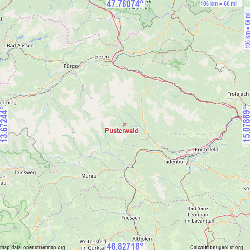
Pusterwald GPS coordinates[2]
47° 18' 21.996" North, 14° 22' 32.016" East
| Map corner | latitude | longitude |
|---|---|---|
| Upper-left | 47.78074°, | 13.67244° |
| Center: | 47.30611°, | 14.37556° |
| Lower-right: | 46.82718°, | 15.07869° |
| Map W x H: | 106×106 km | = 65.9×65.9mi |
| max Lat: | 48.98333° ⇑64.8% North |
| Pusterwald: | 47.30611° |
| min Lat: | ⇓35.2% South 46.48841° |
| min Long | Pusterwald | max Long |
| 9.57802° | 14.37556° | 17.1° |
| W 43.9%⇐ | ⇒56.1% E |
Elevation
Elevation of Pusterwald is 1073 m = 3520 ft, and this is 567.5 m = 1862 ft above average elevation for this country.
| Max E: |
2140 m = 7021 ft | 3.9% |
| Pusterwald | 1073 m 3520 ft | |
| Avg. | 505.5 m = 1658 ft | |
Min E: |
118 m = 387 ft | 96.1% |
See also: Austria elevation on elevation.city.
Geographical zone
Pusterwald is located in North temperate zone (between Tropic of Cancer and the Arctic Circle). Distance of this North polar circle is 2141.2 km =1330.5 mi to North.| Distance of | km | miles | from Pusterwald |
|---|---|---|---|
| North Pole | 4747.1 | 2949.7 | to North |
| Arctic Circle | 2141.2 | 1330.5 | to North |
| Tropic Cancer | 2654 | 1649.1 | to South |
| Equator | 5259.9 | 3268.3 | to South |


Nearby cities:
15 places around Pusterwald: (largest is in red/bold)
• Bretstein
4.3 km =2.7 mi,  45°
45°
• Frauenburg
12.6 km =7.8 mi,  159°
159°
• Hohentauern
16.3 km =10.1 mi,  29°
29°
• Lind bei Scheifling
16.6 km =10.3 mi,  172°
172°
• Möderbrugg
8.8 km =5.5 mi,  112°
112°
• Niederwölz
17.2 km =10.7 mi,  180°
180°
• Oberkurzheim
17.6 km =10.9 mi,  117°
117°
• Oberwölz Stadt
13.6 km =8.5 mi,  210°
210°
• Oberzeiring
10.2 km =6.3 mi,  127°
127°
• Sankt Georgen ob Judenburg
14.3 km =8.9 mi,  140°
140°
• Sankt Johann am Tauern
8.4 km =5.2 mi, 54°
• Scheifling
17.5 km =10.9 mi, 170°
• Unzmarkt
13.1 km =8.1 mi,  154°
154°
• Vorstadt
13.5 km =8.4 mi, 211°
• Winklern bei Oberwölz
16 km =9.9 mi,  222°
222°
Sources, notices
• [Note1] Compared only with cities in Austria existing in our database
• [Src1] Map data: © OpenStreetMap contributors (CC-BY-SA)
• [Src2] Other city data from geonames.org with taken over terms of usage.
• [Src3] Geographical zone / Annual Mean Temperature by Robert A. Rohde @ Wikipedia
