Frauenburg geodata
Frauenburg (Styria) is a populated place; located in Austria in Europe/Vienna (GMT+2) time zone. With population of 601 people, there are 2139 cities with bigger population in this country. Compared to other cities in Austria, 73% of cities are located further ↑North; 54.8% of cities are located further →East and 89.8% of cities have lower elevation than Frauenburg. Note1
Administrative division(s):
- Level 1: Styria
- Level 2: Politischer Bezirk Murtal
- Level 3: Unzmarkt-Frauenburg


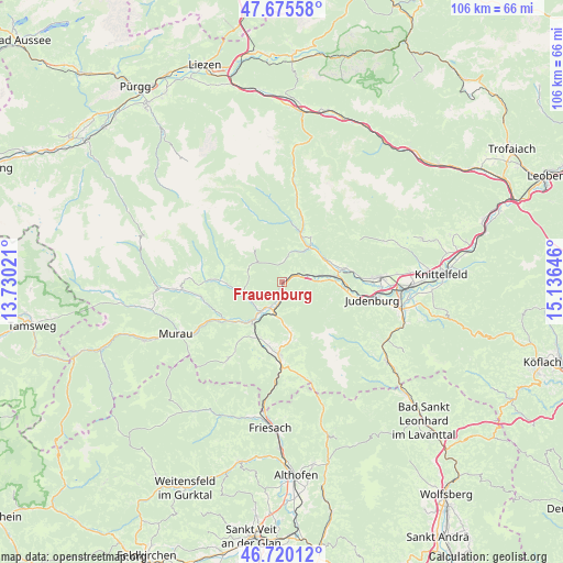
Frauenburg GPS coordinates[2]
47° 12' 0" North, 14° 25' 59.988" East
| Map corner | latitude | longitude |
|---|---|---|
| Upper-left | 47.67558°, | 13.73021° |
| Center: | 47.2°, | 14.43333° |
| Lower-right: | 46.72012°, | 15.13646° |
| Map W x H: | 106.2×106.2 km | = 66×66mi |
| max Lat: | 48.98333° ⇑73% North |
| Frauenburg: | 47.2° |
| min Lat: | ⇓27% South 46.48841° |
| min Long | Frauenburg | max Long |
| 9.57802° | 14.43333° | 17.1° |
| W 45.2%⇐ | ⇒54.8% E |
Elevation
Elevation of Frauenburg is 879 m = 2884 ft, and this is 373.5 m = 1225 ft above average elevation for this country.
| Max E: |
2140 m = 7021 ft | 10.2% |
| Frauenburg | 879 m 2884 ft | |
| Avg. | 505.5 m = 1658 ft | |
Min E: |
118 m = 387 ft | 89.8% |
See also: Austria elevation on elevation.city.
Geographical zone
Frauenburg is located in North temperate zone (between Tropic of Cancer and the Arctic Circle). Distance of this North polar circle is 2153 km =1337.8 mi to North.| Distance of | km | miles | from Frauenburg |
|---|---|---|---|
| North Pole | 4758.9 | 2957 | to North |
| Arctic Circle | 2153 | 1337.8 | to North |
| Tropic Cancer | 2642.2 | 1641.8 | to South |
| Equator | 5248.1 | 3261 | to South |


Nearby cities:
15 places around Frauenburg: (largest is in red/bold)
• Lind bei Scheifling
5.2 km =3.2 mi,  206°
206°
• Mariahof
11.4 km =7.1 mi,  192°
192°
• Möderbrugg
9.3 km =5.8 mi,  24°
24°
• Niederwölz
7 km =4.3 mi,  219°
219°
• Oberwölz Stadt
11.3 km =7 mi,  270°
270°
• Oberzeiring
6.7 km =4.2 mi,  34°
34°
• Perchau am Sattel
11.2 km =7 mi,  173°
173°
• Pöls
11.5 km =7.1 mi,  80°
80°
• Sankt Georgen ob Judenburg
4.9 km =3 mi, 80°
• Sankt Lorenzen bei Scheifling
6.4 km =4 mi,  198°
198°
• Sankt Peter ob Judenburg
11.7 km =7.3 mi,  98°
98°
• Scheifling
5.7 km =3.5 mi, 195°
• Teufenbach
9.7 km =6 mi, 215°
• Unzmarkt
1.3 km =0.8 mi,  90°
90°
• Vorstadt
11.4 km =7.1 mi, 271°
Sources, notices
• [Note1] Compared only with cities in Austria existing in our database
• [Src1] Map data: © OpenStreetMap contributors (CC-BY-SA)
• [Src2] Other city data from geonames.org with taken over terms of usage.
• [Src3] Geographical zone / Annual Mean Temperature by Robert A. Rohde @ Wikipedia
