Kapellen geodata
Kapellen (Styria) is a seat of a third-order administrative division; located in Austria in Europe/Vienna (GMT+2) time zone. With population of 428 people, there are 2588 cities with bigger population in this country. Compared to other cities in Austria, 51.8% of cities are located further ↓South; 69.8% of cities are located further ←West and 79.1% of cities have lower elevation than Kapellen. Note1
Administrative division(s):
- Level 1: Styria
- Level 2: Politischer Bezirk Bruck-Mürzzuschlag
- Level 3: Neuberg an der Mürz


Kapellen GPS coordinates[2]
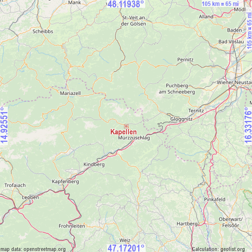
47° 38' 52.224" North, 15° 37' 43.068" East
| Map corner | latitude | longitude |
|---|---|---|
| Upper-left | 48.11938°, | 14.92551° |
| Center: | 47.64784°, | 15.62863° |
| Lower-right: | 47.17201°, | 16.33176° |
| Map W x H: | 105.3×105.3 km | = 65.4×65.4mi |
| max Lat: | 48.98333° ⇑48.2% North |
| Kapellen: | 47.64784° |
| min Lat: | ⇓51.8% South 46.48841° |
| min Long | Kapellen | max Long |
| 9.57802° | 15.62863° | 17.1° |
| W 69.8%⇐ | ⇒30.2% E |
Elevation
Elevation of Kapellen is 701 m = 2300 ft, and this is 195.5 m = 641 ft above average elevation for this country.
| Max E: |
2140 m = 7021 ft | 20.9% |
| Kapellen | 701 m 2300 ft | |
| Avg. | 505.5 m = 1658 ft | |
Min E: |
118 m = 387 ft | 79.1% |
See also: Austria elevation on elevation.city.
Geographical zone
Kapellen is located in North temperate zone (between Tropic of Cancer and the Arctic Circle). Distance of this North polar circle is 2103.2 km =1306.9 mi to North.| Distance of | km | miles | from Kapellen |
|---|---|---|---|
| North Pole | 4709.1 | 2926.1 | to North |
| Arctic Circle | 2103.2 | 1306.9 | to North |
| Tropic Cancer | 2692 | 1672.7 | to South |
| Equator | 5297.9 | 3292 | to South |


Nearby cities:
15 places around Kapellen: (largest is in red/bold)
• Alpl
6.1 km =3.8 mi,  310°
310°
• Fressnitz
13.5 km =8.4 mi,  211°
211°
• Ganz
6.7 km =4.2 mi,  142°
142°
• Grossveitsch
13.5 km =8.4 mi,  240°
240°
• Hönigsberg
7.6 km =4.7 mi,  169°
169°
• Krieglach
12.2 km =7.6 mi,  203°
203°
• Langenwang
9.1 km =5.7 mi,  185°
185°
• Mürzsteg
10.7 km =6.6 mi,  286°
286°
• Mürzzuschlag
5.6 km =3.5 mi, 144°
• Neuberg an der Mürz
4.6 km =2.9 mi, 293°
• Niederaigen
13 km =8.1 mi,  227°
227°
• Sommer
11.5 km =7.1 mi,  218°
218°
• Spital am Semmering
9.9 km =6.2 mi,  112°
112°
• Steinhaus am Semmering
13.3 km =8.3 mi, 105°
• Veitsch
12.7 km =7.9 mi, 232°
Sources, notices
• [Note1] Compared only with cities in Austria existing in our database
• [Src1] Map data: © OpenStreetMap contributors (CC-BY-SA)
• [Src2] Other city data from geonames.org with taken over terms of usage.
• [Src3] Geographical zone / Annual Mean Temperature by Robert A. Rohde @ Wikipedia
