Alpl geodata
Alpl (Styria) is a populated place; located in Austria in Europe/Vienna (GMT+2) time zone. With population of 567 people, there are 2257 cities with bigger population in this country. Compared to other cities in Austria, 52.8% of cities are located further ↓South; 67.2% of cities are located further ←West and 91.2% of cities have lower elevation than Alpl. Note1
Administrative division(s):
- Level 1: Styria
- Level 2: Politischer Bezirk Bruck-Mürzzuschlag
- Level 3: Neuberg an der Mürz


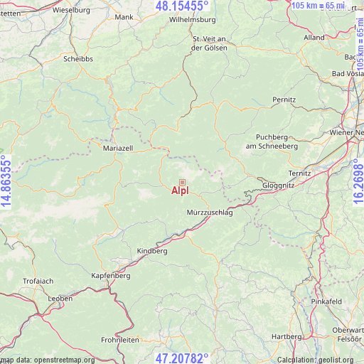
Alpl GPS coordinates[2]
47° 40' 59.988" North, 15° 34' 0.012" East
| Map corner | latitude | longitude |
|---|---|---|
| Upper-left | 48.15455°, | 14.86355° |
| Center: | 47.68333°, | 15.56667° |
| Lower-right: | 47.20782°, | 16.2698° |
| Map W x H: | 105.3×105.3 km | = 65.4×65.4mi |
| max Lat: | 48.98333° ⇑47.2% North |
| Alpl: | 47.68333° |
| min Lat: | ⇓52.8% South 46.48841° |
| min Long | Alpl | max Long |
| 9.57802° | 15.56667° | 17.1° |
| W 67.2%⇐ | ⇒32.8% E |
Elevation
Elevation of Alpl is 906 m = 2972 ft, and this is 400.5 m = 1314 ft above average elevation for this country.
| Max E: |
2140 m = 7021 ft | 8.8% |
| Alpl | 906 m 2972 ft | |
| Avg. | 505.5 m = 1658 ft | |
Min E: |
118 m = 387 ft | 91.2% |
See also: Austria elevation on elevation.city.
Geographical zone
Alpl is located in North temperate zone (between Tropic of Cancer and the Arctic Circle). Distance of this North polar circle is 2099.3 km =1304.4 mi to North.| Distance of | km | miles | from Alpl |
|---|---|---|---|
| North Pole | 4705.2 | 2923.7 | to North |
| Arctic Circle | 2099.3 | 1304.4 | to North |
| Tropic Cancer | 2696 | 1675.2 | to South |
| Equator | 5301.9 | 3294.4 | to South |


Nearby cities:
15 places around Alpl: (largest is in red/bold)
• Fressnitz
15.6 km =9.7 mi,  188°
188°
• Ganz
12.7 km =7.9 mi,  136°
136°
• Grossveitsch
12.7 km =7.9 mi,  213°
213°
• Hönigsberg
13 km =8.1 mi,  151°
151°
• Kapellen
6.1 km =3.8 mi,  130°
130°
• Krieglach
15.1 km =9.4 mi,  181°
181°
• Langenwang
13.5 km =8.4 mi,  163°
163°
• Mitterdorf im Mürztal
17.1 km =10.6 mi, 192°
• Mürzsteg
5.7 km =3.5 mi,  261°
261°
• Mürzzuschlag
11.6 km =7.2 mi, 137°
• Neuberg an der Mürz
2.2 km =1.4 mi,  168°
168°
• Niederaigen
13.6 km =8.5 mi,  201°
201°
• Sommer
13.2 km =8.2 mi, 190°
• Spital am Semmering
15.8 km =9.8 mi,  119°
119°
• Veitsch
12.9 km =8 mi, 204°
Sources, notices
• [Note1] Compared only with cities in Austria existing in our database
• [Src1] Map data: © OpenStreetMap contributors (CC-BY-SA)
• [Src2] Other city data from geonames.org with taken over terms of usage.
• [Src3] Geographical zone / Annual Mean Temperature by Robert A. Rohde @ Wikipedia
