Hötting geodata
Hötting (Tyrol) is a section of populated place; located in Austria in Europe/Vienna (GMT+2) time zone. With population of 35,043 people, there are 18 cities with bigger population in this country. Compared to other cities in Austria, 67.9% of cities are located further ↑North; 92.4% of cities are located further →East and 73.9% of cities have lower elevation than Hötting. Note1


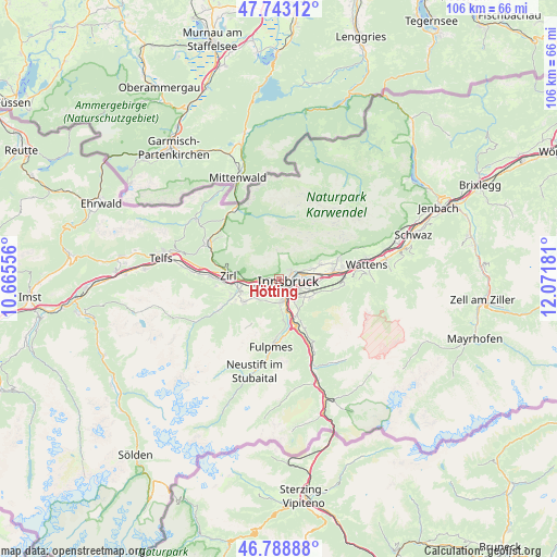
Hötting GPS coordinates[2]
47° 16' 5.34" North, 11° 22' 7.248" East
| Map corner | latitude | longitude |
|---|---|---|
| Upper-left | 47.74312°, | 10.66556° |
| Center: | 47.26815°, | 11.36868° |
| Lower-right: | 46.78888°, | 12.07181° |
| Map W x H: | 106.1×106.1 km | = 65.9×65.9mi |
| max Lat: | 48.98333° ⇑67.9% North |
| Hötting: | 47.26815° |
| min Lat: | ⇓32.1% South 46.48841° |
| min Long | Hötting | max Long |
| 9.57802° | 11.36868° | 17.1° |
| W 7.6%⇐ | ⇒92.4% E |
Elevation
Elevation of Hötting is 636 m = 2087 ft, and this is 130.5 m = 428 ft above average elevation for this country.
| Max E: |
2140 m = 7021 ft | 26.1% |
| Hötting | 636 m 2087 ft | |
| Avg. | 505.5 m = 1658 ft | |
Min E: |
118 m = 387 ft | 73.9% |
See also: Austria elevation on elevation.city.
Geographical zone
Hötting is located in North temperate zone (between Tropic of Cancer and the Arctic Circle). Distance of this North polar circle is 2145.4 km =1333.1 mi to North.| Distance of | km | miles | from Hötting |
|---|---|---|---|
| North Pole | 4751.3 | 2952.3 | to North |
| Arctic Circle | 2145.4 | 1333.1 | to North |
| Tropic Cancer | 2649.8 | 1646.5 | to South |
| Equator | 5255.7 | 3265.7 | to South |


Nearby cities:
15 places around Hötting: (largest is in red/bold)
• Amras
4.1 km =2.5 mi,  119°
119°
• Arzl
5.2 km =3.2 mi,  70°
70°
• Birgitz
6.4 km =4 mi,  235°
235°
• Götzens
5.6 km =3.5 mi,  230°
230°
• Igls
5.2 km =3.2 mi,  142°
142°
• Innsbruck
2 km =1.2 mi,  107°
107°
• Lans
5.8 km =3.6 mi,  125°
125°
• Mutters
4 km =2.5 mi,  164°
164°
• Mühlau
2.9 km =1.8 mi,  54°
54°
• Natters
3.8 km =2.4 mi,  174°
174°
• Pradl
3.5 km =2.2 mi,  94°
94°
• Rum
6.4 km =4 mi, 74°
• Vill
4.5 km =2.8 mi,  148°
148°
• Völs
3.3 km =2.1 mi, 232°
• Wilten
1.8 km =1.1 mi, 126°
Sources, notices
• [Note1] Compared only with cities in Austria existing in our database
• [Src1] Map data: © OpenStreetMap contributors (CC-BY-SA)
• [Src2] Other city data from geonames.org with taken over terms of usage.
• [Src3] Geographical zone / Annual Mean Temperature by Robert A. Rohde @ Wikipedia
