Hafendorf geodata
Hafendorf (Styria) is a populated place; located in Austria in Europe/Vienna (GMT+2) time zone. With population of 6,506 people, there are 148 cities with bigger population in this country. Compared to other cities in Austria, 56.2% of cities are located further ↑North; 60.7% of cities are located further ←West and 61.1% of cities have lower elevation than Hafendorf. Note1
Administrative division(s):
- Level 1: Styria
- Level 2: Politischer Bezirk Bruck-Mürzzuschlag
- Level 3: Kapfenberg


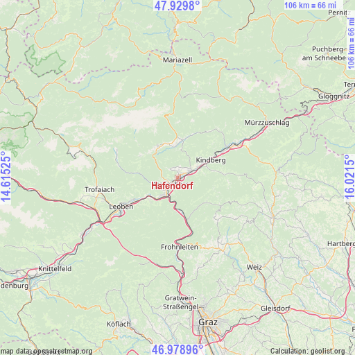
Hafendorf GPS coordinates[2]
47° 27' 23.508" North, 15° 19' 6.132" East
| Map corner | latitude | longitude |
|---|---|---|
| Upper-left | 47.9298°, | 14.61525° |
| Center: | 47.45653°, | 15.31837° |
| Lower-right: | 46.97896°, | 16.0215° |
| Map W x H: | 105.7×105.7 km | = 65.7×65.7mi |
| max Lat: | 48.98333° ⇑56.2% North |
| Hafendorf: | 47.45653° |
| min Lat: | ⇓43.8% South 46.48841° |
| min Long | Hafendorf | max Long |
| 9.57802° | 15.31837° | 17.1° |
| W 60.7%⇐ | ⇒39.3% E |
Elevation
Elevation of Hafendorf is 525 m = 1722 ft, and this is 19.5 m = 64 ft above average elevation for this country.
| Max E: |
2140 m = 7021 ft | 38.9% |
| Hafendorf | 525 m 1722 ft | |
| Avg. | 505.5 m = 1658 ft | |
Min E: |
118 m = 387 ft | 61.1% |
See also: Austria elevation on elevation.city.
Geographical zone
Hafendorf is located in North temperate zone (between Tropic of Cancer and the Arctic Circle). Distance of this North polar circle is 2124.5 km =1320.1 mi to North.| Distance of | km | miles | from Hafendorf |
|---|---|---|---|
| North Pole | 4730.4 | 2939.3 | to North |
| Arctic Circle | 2124.5 | 1320.1 | to North |
| Tropic Cancer | 2670.8 | 1659.6 | to South |
| Equator | 5276.7 | 3278.8 | to South |


Nearby cities:
15 places around Hafendorf: (largest is in red/bold)
• Allerheiligen im Mürztal
6.2 km =3.9 mi,  79°
79°
• Berndorf
5.9 km =3.7 mi,  221°
221°
• Bruck an der Mur
5.2 km =3.2 mi,  210°
210°
• Deuchendorf
1.1 km =0.7 mi,  13°
13°
• Diemlach
4 km =2.5 mi,  235°
235°
• Frauenberg
3.6 km =2.2 mi,  150°
150°
• Gassing
2.6 km =1.6 mi,  46°
46°
• Göritz
3.4 km =2.1 mi,  17°
17°
• Kapfenberg
2.3 km =1.4 mi,  234°
234°
• Mürzhofen
5.7 km =3.5 mi,  58°
58°
• Parschlug
3.6 km =2.2 mi,  318°
318°
• Sankt Lorenzen im Mürztal
4.7 km =2.9 mi, 50°
• Sankt Marein im Mürztal
3.8 km =2.4 mi,  72°
72°
• Sankt Martin
2.7 km =1.7 mi,  246°
246°
• Schaldorf
4.3 km =2.7 mi, 71°
Sources, notices
• [Note1] Compared only with cities in Austria existing in our database
• [Src1] Map data: © OpenStreetMap contributors (CC-BY-SA)
• [Src2] Other city data from geonames.org with taken over terms of usage.
• [Src3] Geographical zone / Annual Mean Temperature by Robert A. Rohde @ Wikipedia
