Gassing geodata
Gassing (Styria) is a populated place; located in Austria in Europe/Vienna (GMT+2) time zone. With population of 582 people, there are 2203 cities with bigger population in this country. Compared to other cities in Austria, 55.2% of cities are located further ↑North; 61.5% of cities are located further ←West and 62.7% of cities have lower elevation than Gassing. Note1
Administrative division(s):
- Level 1: Styria
- Level 2: Politischer Bezirk Bruck-Mürzzuschlag
- Level 3: Sankt Lorenzen im Mürztal


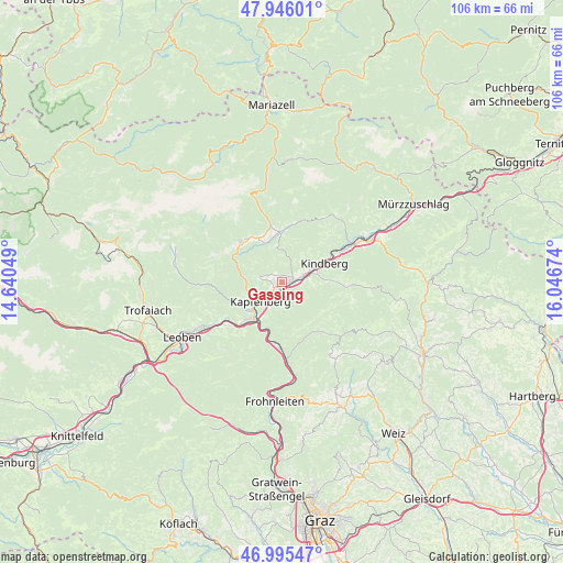
Gassing GPS coordinates[2]
47° 28' 22.404" North, 15° 20' 36.996" East
| Map corner | latitude | longitude |
|---|---|---|
| Upper-left | 47.94601°, | 14.64049° |
| Center: | 47.47289°, | 15.34361° |
| Lower-right: | 46.99547°, | 16.04674° |
| Map W x H: | 105.7×105.7 km | = 65.7×65.7mi |
| max Lat: | 48.98333° ⇑55.2% North |
| Gassing: | 47.47289° |
| min Lat: | ⇓44.8% South 46.48841° |
| min Long | Gassing | max Long |
| 9.57802° | 15.34361° | 17.1° |
| W 61.5%⇐ | ⇒38.5% E |
Elevation
Elevation of Gassing is 537 m = 1762 ft, and this is 31.5 m = 103 ft above average elevation for this country.
| Max E: |
2140 m = 7021 ft | 37.3% |
| Gassing | 537 m 1762 ft | |
| Avg. | 505.5 m = 1658 ft | |
Min E: |
118 m = 387 ft | 62.7% |
See also: Austria elevation on elevation.city.
Geographical zone
Gassing is located in North temperate zone (between Tropic of Cancer and the Arctic Circle). Distance of this North polar circle is 2122.7 km =1319 mi to North.| Distance of | km | miles | from Gassing |
|---|---|---|---|
| North Pole | 4728.6 | 2938.2 | to North |
| Arctic Circle | 2122.7 | 1319 | to North |
| Tropic Cancer | 2672.6 | 1660.7 | to South |
| Equator | 5278.5 | 3279.9 | to South |


Nearby cities:
15 places around Gassing: (largest is in red/bold)
• Allerheiligen im Mürztal
4.3 km =2.7 mi,  99°
99°
• Bruck an der Mur
7.7 km =4.8 mi,  215°
215°
• Deuchendorf
1.8 km =1.1 mi,  244°
244°
• Diemlach
6.6 km =4.1 mi,  231°
231°
• Frauenberg
4.9 km =3 mi,  181°
181°
• Göritz
1.7 km =1.1 mi,  329°
329°
• Hafendorf
2.6 km =1.6 mi, 226°
• Kapfenberg
4.9 km =3 mi, 230°
• Kindberg
8.5 km =5.3 mi,  69°
69°
• Mürzhofen
3.2 km =2 mi, 68°
• Parschlug
4.4 km =2.7 mi,  281°
281°
• Sankt Lorenzen im Mürztal
2.1 km =1.3 mi,  56°
56°
• Sankt Marein im Mürztal
1.9 km =1.2 mi,  111°
111°
• Sankt Martin
5.3 km =3.3 mi, 236°
• Schaldorf
2.2 km =1.4 mi, 100°
Sources, notices
• [Note1] Compared only with cities in Austria existing in our database
• [Src1] Map data: © OpenStreetMap contributors (CC-BY-SA)
• [Src2] Other city data from geonames.org with taken over terms of usage.
• [Src3] Geographical zone / Annual Mean Temperature by Robert A. Rohde @ Wikipedia
