Gschwendt geodata
Gschwendt (Styria) is a populated place; located in Austria in Europe/Vienna (GMT+2) time zone. With population of 941 people, there are 1366 cities with bigger population in this country. Compared to other cities in Austria, 74.2% of cities are located further ↑North; 67.7% of cities are located further ←West and 56.7% of cities have lower elevation than Gschwendt. Note1
Administrative division(s):
- Level 1: Styria
- Level 2: Politischer Bezirk Graz-Umgebung
- Level 3: Kumberg


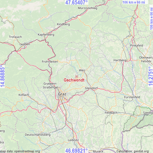
Gschwendt GPS coordinates[2]
47° 10' 41.844" North, 15° 34' 19.092" East
| Map corner | latitude | longitude |
|---|---|---|
| Upper-left | 47.65407°, | 14.86885° |
| Center: | 47.17829°, | 15.57197° |
| Lower-right: | 46.69821°, | 16.2751° |
| Map W x H: | 106.3×106.3 km | = 66.1×66.1mi |
| max Lat: | 48.98333° ⇑74.2% North |
| Gschwendt: | 47.17829° |
| min Lat: | ⇓25.8% South 46.48841° |
| min Long | Gschwendt | max Long |
| 9.57802° | 15.57197° | 17.1° |
| W 67.7%⇐ | ⇒32.3% E |
Elevation
Elevation of Gschwendt is 496 m = 1627 ft, and this is 9.5 m = 31 ft below average elevation for this country.
| Max E: |
2140 m = 7021 ft | 43.3% |
| Avg. | 505.5 m = 1658 ft | |
| Gschwendt | 496 m = 1627 ft | |
Min E: |
118 m = 387 ft | 56.7% |
See also: Austria elevation on elevation.city.
Geographical zone
Gschwendt is located in North temperate zone (between Tropic of Cancer and the Arctic Circle). Distance of this North polar circle is 2155.4 km =1339.3 mi to North.| Distance of | km | miles | from Gschwendt |
|---|---|---|---|
| North Pole | 4761.3 | 2958.5 | to North |
| Arctic Circle | 2155.4 | 1339.3 | to North |
| Tropic Cancer | 2639.8 | 1640.3 | to South |
| Equator | 5245.7 | 3259.5 | to South |


Nearby cities:
15 places around Gschwendt: (largest is in red/bold)
• Eggersdorf bei Graz
6.5 km =4 mi,  160°
160°
• Göttelsberg
4.8 km =3 mi,  26°
26°
• Hart bei Eggersdorf
5 km =3.1 mi,  184°
184°
• Kleinsemmering
1.3 km =0.8 mi,  11°
11°
• Krottendorf
5.2 km =3.2 mi,  62°
62°
• Kumberg
3.4 km =2.1 mi,  242°
242°
• Landscha bei Weiz
5.4 km =3.4 mi,  38°
38°
• Mitterdorf an der Raab
2.5 km =1.6 mi,  121°
121°
• Mortantsch
3.3 km =2.1 mi, 9°
• Niederschöckl
6.3 km =3.9 mi, 239°
• Preding
5.9 km =3.7 mi,  84°
84°
• Rabnitz
5.2 km =3.2 mi,  233°
233°
• Sankt Radegund bei Graz
6.1 km =3.8 mi,  273°
273°
• Stenzengreith
4.8 km =3 mi,  300°
300°
• Weiz
5.4 km =3.4 mi, 38°
Sources, notices
• [Note1] Compared only with cities in Austria existing in our database
• [Src1] Map data: © OpenStreetMap contributors (CC-BY-SA)
• [Src2] Other city data from geonames.org with taken over terms of usage.
• [Src3] Geographical zone / Annual Mean Temperature by Robert A. Rohde @ Wikipedia
