Götzis geodata
Götzis (Vorarlberg) is a seat of a third-order administrative division; located in Austria in Europe/Vienna (GMT+2) time zone. With population of 11,473 people, there are 66 cities with bigger population in this country. Compared to other cities in Austria, 63.5% of cities are located further ↑North; 99.8% of cities are located further →East and 53.9% of cities have higher elevation than Götzis. Note1
Administrative division(s):
- Level 1: Vorarlberg
- Level 2: Politischer Bezirk Feldkirch
- Level 3: Götzis


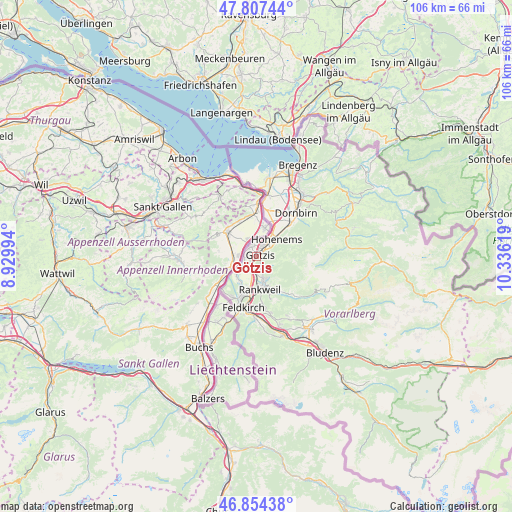
Götzis GPS coordinates[2]
47° 19' 59.016" North, 9° 37' 59.016" East
| Map corner | latitude | longitude |
|---|---|---|
| Upper-left | 47.80744°, | 8.92994° |
| Center: | 47.33306°, | 9.63306° |
| Lower-right: | 46.85438°, | 10.33619° |
| Map W x H: | 106×106 km | = 65.9×65.9mi |
| max Lat: | 48.98333° ⇑63.5% North |
| Götzis: | 47.33306° |
| min Lat: | ⇓36.5% South 46.48841° |
| min Long | Götzis | max Long |
| 9.57802° | 9.63306° | 17.1° |
| W 0.2%⇐ | ⇒99.8% E |
Elevation
Elevation of Götzis is 427 m = 1401 ft, and this is 78.5 m = 258 ft below average elevation for this country.
| Max E: |
2140 m = 7021 ft | 53.9% |
| Avg. | 505.5 m = 1658 ft | |
| Götzis | 427 m = 1401 ft | |
Min E: |
118 m = 387 ft | 46.1% |
See also: Austria elevation on elevation.city.
Geographical zone
Götzis is located in North temperate zone (between Tropic of Cancer and the Arctic Circle). Distance of this North polar circle is 2138.2 km =1328.6 mi to North.| Distance of | km | miles | from Götzis |
|---|---|---|---|
| North Pole | 4744.1 | 2947.8 | to North |
| Arctic Circle | 2138.2 | 1328.6 | to North |
| Tropic Cancer | 2657 | 1651 | to South |
| Equator | 5262.9 | 3270.2 | to South |


Nearby cities:
15 places around Götzis: (largest is in red/bold)
• Altach
2.3 km =1.4 mi,  34°
34°
• Batschuns
5.7 km =3.5 mi,  167°
167°
• Fraxern
3.7 km =2.3 mi,  123°
123°
• Hohenems
5.3 km =3.3 mi,  45°
45°
• Klaus
2.9 km =1.8 mi,  158°
158°
• Koblach
2.5 km =1.6 mi,  270°
270°
• Meiningen
5.6 km =3.5 mi,  227°
227°
• Muntlix
5.9 km =3.7 mi, 160°
• Mäder
2.3 km =1.4 mi,  326°
326°
• Rankweil
6.9 km =4.3 mi, 173°
• Röthis
4.7 km =2.9 mi, 159°
• Sulz
5.3 km =3.3 mi, 164°
• Tal
8.9 km =5.5 mi,  145°
145°
• Viktorsberg
4.8 km =3 mi,  138°
138°
• Weiler
3.9 km =2.4 mi, 160°
Sources, notices
• [Note1] Compared only with cities in Austria existing in our database
• [Src1] Map data: © OpenStreetMap contributors (CC-BY-SA)
• [Src2] Other city data from geonames.org with taken over terms of usage.
• [Src3] Geographical zone / Annual Mean Temperature by Robert A. Rohde @ Wikipedia
