Pöls geodata
Pöls (Styria) is a seat of a third-order administrative division; located in Austria in Europe/Vienna (GMT+2) time zone. With population of 1,485 people, there are 848 cities with bigger population in this country. Compared to other cities in Austria, 71.6% of cities are located further ↑North; 52% of cities are located further →East and 84.6% of cities have lower elevation than Pöls. Note1
Administrative division(s):
- Level 1: Styria
- Level 2: Politischer Bezirk Murtal
- Level 3: Pöls-Oberkurzheim


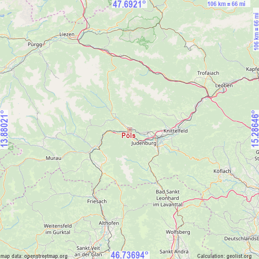
Pöls GPS coordinates[2]
47° 13' 0.012" North, 14° 34' 59.988" East
| Map corner | latitude | longitude |
|---|---|---|
| Upper-left | 47.6921°, | 13.88021° |
| Center: | 47.21667°, | 14.58333° |
| Lower-right: | 46.73694°, | 15.28646° |
| Map W x H: | 106.2×106.2 km | = 66×66mi |
| max Lat: | 48.98333° ⇑71.6% North |
| Pöls: | 47.21667° |
| min Lat: | ⇓28.4% South 46.48841° |
| min Long | Pöls | max Long |
| 9.57802° | 14.58333° | 17.1° |
| W 48%⇐ | ⇒52% E |
Elevation
Elevation of Pöls is 791 m = 2595 ft, and this is 285.5 m = 937 ft above average elevation for this country.
| Max E: |
2140 m = 7021 ft | 15.4% |
| Pöls | 791 m 2595 ft | |
| Avg. | 505.5 m = 1658 ft | |
Min E: |
118 m = 387 ft | 84.6% |
See also: Austria elevation on elevation.city.
Geographical zone
Pöls is located in North temperate zone (between Tropic of Cancer and the Arctic Circle). Distance of this North polar circle is 2151.2 km =1336.7 mi to North.| Distance of | km | miles | from Pöls |
|---|---|---|---|
| North Pole | 4757.1 | 2955.9 | to North |
| Arctic Circle | 2151.2 | 1336.7 | to North |
| Tropic Cancer | 2644.1 | 1643 | to South |
| Equator | 5250 | 3262.2 | to South |


Nearby cities:
15 places around Pöls: (largest is in red/bold)
• Dietersdorf
6.6 km =4.1 mi,  106°
106°
• Farrach
11.9 km =7.4 mi, 108°
• Fohnsdorf
7.8 km =4.8 mi,  103°
103°
• Frauenburg
11.5 km =7.1 mi,  260°
260°
• Gaal
9 km =5.6 mi,  46°
46°
• Hetzendorf
8.4 km =5.2 mi,  116°
116°
• Judenburg
8.4 km =5.2 mi,  131°
131°
• Möderbrugg
10 km =6.2 mi,  311°
311°
• Oberkurzheim
1.9 km =1.2 mi,  0°
0°
• Oberweg
8.3 km =5.2 mi,  152°
152°
• Oberzeiring
8.4 km =5.2 mi,  296°
296°
• Reifling
11.2 km =7 mi, 145°
• Sankt Georgen ob Judenburg
6.6 km =4.1 mi, 261°
• Sankt Peter ob Judenburg
3.6 km =2.2 mi,  176°
176°
• Unzmarkt
10.2 km =6.3 mi, 259°
Sources, notices
• [Note1] Compared only with cities in Austria existing in our database
• [Src1] Map data: © OpenStreetMap contributors (CC-BY-SA)
• [Src2] Other city data from geonames.org with taken over terms of usage.
• [Src3] Geographical zone / Annual Mean Temperature by Robert A. Rohde @ Wikipedia
