Ferlach geodata
Ferlach (Carinthia) is a seat of a third-order administrative division; located in Austria in Europe/Vienna (GMT+2) time zone. With population of 4,342 people, there are 230 cities with bigger population in this country. Compared to other cities in Austria, 99.9% of cities are located further ↑North; 57.8% of cities are located further →East and 52% of cities have lower elevation than Ferlach. Note1
Administrative division(s):
- Level 1: Carinthia
- Level 2: Politischer Bezirk Klagenfurt Land
- Level 3: Ferlach


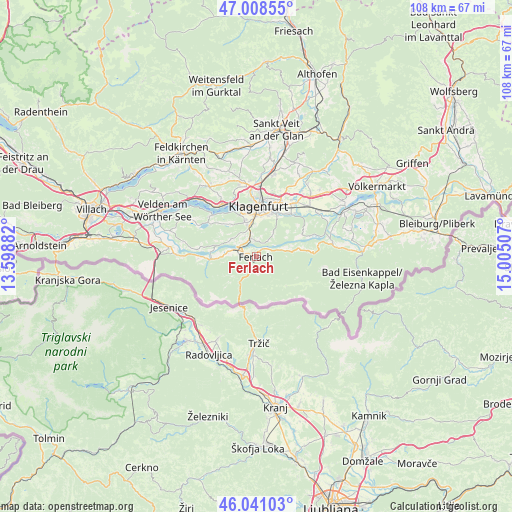
Ferlach GPS coordinates[2]
46° 31' 36.984" North, 14° 18' 6.984" East
| Map corner | latitude | longitude |
|---|---|---|
| Upper-left | 47.00855°, | 13.59882° |
| Center: | 46.52694°, | 14.30194° |
| Lower-right: | 46.04103°, | 15.00507° |
| Map W x H: | 107.6×107.6 km | = 66.9×66.9mi |
| max Lat: | 48.98333° ⇑99.9% North |
| Ferlach: | 46.52694° |
| min Lat: | ⇓0.1% South 46.48841° |
| min Long | Ferlach | max Long |
| 9.57802° | 14.30194° | 17.1° |
| W 42.2%⇐ | ⇒57.8% E |
Elevation
Elevation of Ferlach is 464 m = 1522 ft, and this is 41.5 m = 136 ft below average elevation for this country.
| Max E: |
2140 m = 7021 ft | 48% |
| Avg. | 505.5 m = 1658 ft | |
| Ferlach | 464 m = 1522 ft | |
Min E: |
118 m = 387 ft | 52% |
See also: Austria elevation on elevation.city.
Geographical zone
Ferlach is located in North temperate zone (between Tropic of Cancer and the Arctic Circle). Distance of this North polar circle is 2227.9 km =1384.4 mi to North.| Distance of | km | miles | from Ferlach |
|---|---|---|---|
| North Pole | 4833.8 | 3003.6 | to North |
| Arctic Circle | 2227.9 | 1384.4 | to North |
| Tropic Cancer | 2567.4 | 1595.3 | to South |
| Equator | 5173.3 | 3214.5 | to South |


Nearby cities:
15 places around Ferlach: (largest is in red/bold)
• 3.Bezirk
10.7 km =6.6 mi,  3°
3°
• 4.Bezirk
10.6 km =6.6 mi, 1°
• Ebenthal
10.2 km =6.3 mi,  27°
27°
• Feistritz im Rosental
10.4 km =6.5 mi,  263°
263°
• Innere Stadt
10.8 km =6.7 mi, 2°
• Köttmannsdorf
6.5 km =4 mi,  306°
306°
• Maria Rain
3 km =1.9 mi,  350°
350°
• Rain
10.8 km =6.7 mi,  36°
36°
• Reichersdorf
9.5 km =5.9 mi, 31°
• Sankt Margareten im Rosental
9.6 km =6 mi,  78°
78°
• Sankt Martin
10.1 km =6.3 mi, 351°
• Sankt Ruprecht
8.2 km =5.1 mi,  7°
7°
• Viktring
7.6 km =4.7 mi,  340°
340°
• Viktringer Vorstadt
10.1 km =6.3 mi, 3°
• Villacher Vorstadt
10.8 km =6.7 mi, 354°
Sources, notices
• [Note1] Compared only with cities in Austria existing in our database
• [Src1] Map data: © OpenStreetMap contributors (CC-BY-SA)
• [Src2] Other city data from geonames.org with taken over terms of usage.
• [Src3] Geographical zone / Annual Mean Temperature by Robert A. Rohde @ Wikipedia
