Beschling geodata
Beschling (Vorarlberg) is a populated place; located in Austria in Europe/Vienna (GMT+2) time zone. With population of 511 people, there are 2465 cities with bigger population in this country. Compared to other cities in Austria, 73.3% of cities are located further ↑North; 99.2% of cities are located further →East and 65.9% of cities have lower elevation than Beschling. Note1
Administrative division(s):
- Level 1: Vorarlberg
- Level 2: Politischer Bezirk Bludenz
- Level 3: Nenzing


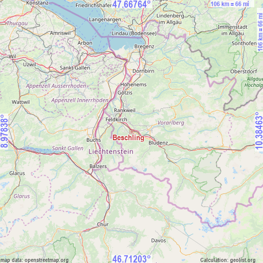
Beschling GPS coordinates[2]
47° 11' 31.164" North, 9° 40' 53.4" East
| Map corner | latitude | longitude |
|---|---|---|
| Upper-left | 47.66764°, | 8.97838° |
| Center: | 47.19199°, | 9.6815° |
| Lower-right: | 46.71203°, | 10.38463° |
| Map W x H: | 106.3×106.3 km | = 66.1×66.1mi |
| max Lat: | 48.98333° ⇑73.3% North |
| Beschling: | 47.19199° |
| min Lat: | ⇓26.7% South 46.48841° |
| min Long | Beschling | max Long |
| 9.57802° | 9.6815° | 17.1° |
| W 0.8%⇐ | ⇒99.2% E |
Elevation
Elevation of Beschling is 558 m = 1831 ft, and this is 52.5 m = 172 ft above average elevation for this country.
| Max E: |
2140 m = 7021 ft | 34.1% |
| Beschling | 558 m 1831 ft | |
| Avg. | 505.5 m = 1658 ft | |
Min E: |
118 m = 387 ft | 65.9% |
See also: Austria elevation on elevation.city.
Geographical zone
Beschling is located in North temperate zone (between Tropic of Cancer and the Arctic Circle). Distance of this North polar circle is 2153.9 km =1338.4 mi to North.| Distance of | km | miles | from Beschling |
|---|---|---|---|
| North Pole | 4759.8 | 2957.6 | to North |
| Arctic Circle | 2153.9 | 1338.4 | to North |
| Tropic Cancer | 2641.3 | 1641.2 | to South |
| Equator | 5247.3 | 3260.5 | to South |


Nearby cities:
15 places around Beschling: (largest is in red/bold)
• Bludesch
4 km =2.5 mi,  77°
77°
• Düns
4.4 km =2.7 mi,  37°
37°
• Dünserberg
5.1 km =3.2 mi, 38°
• Feldkirch
7.7 km =4.8 mi,  306°
306°
• Frastanz
4.8 km =3 mi, 305°
• Göfis
5.8 km =3.6 mi,  322°
322°
• Ludesch
7.7 km =4.8 mi, 83°
• Mittelberg
3.3 km =2.1 mi,  297°
297°
• Nenzing
2 km =1.2 mi,  115°
115°
• Röns
3.1 km =1.9 mi,  26°
26°
• Satteins
3 km =1.9 mi,  337°
337°
• Schlins
1.7 km =1.1 mi,  57°
57°
• Schnifis
4.8 km =3 mi,  54°
54°
• Thüringen
6.5 km =4 mi, 82°
• Übersaxen
6.8 km =4.2 mi,  353°
353°
Sources, notices
• [Note1] Compared only with cities in Austria existing in our database
• [Src1] Map data: © OpenStreetMap contributors (CC-BY-SA)
• [Src2] Other city data from geonames.org with taken over terms of usage.
• [Src3] Geographical zone / Annual Mean Temperature by Robert A. Rohde @ Wikipedia
