Zaubertal geodata
Zaubertal (Upper Austria) is a populated place; located in Austria in Europe/Vienna (GMT+2) time zone. With population of 815 people, there are 1585 cities with bigger population in this country. Compared to other cities in Austria, 86% of cities are located further ↓South; 59.3% of cities are located further →East and 72.7% of cities have higher elevation than Zaubertal. Note1
Administrative division(s):
- Level 1: Upper Austria
- Level 2: Politischer Bezirk Linz-Land
- Level 3: Leonding


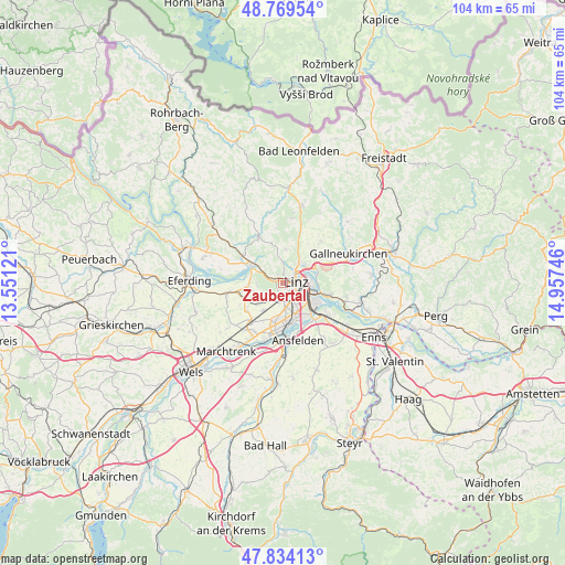
Zaubertal GPS coordinates[2]
48° 18' 14.328" North, 14° 15' 15.588" East
| Map corner | latitude | longitude |
|---|---|---|
| Upper-left | 48.76954°, | 13.55121° |
| Center: | 48.30398°, | 14.25433° |
| Lower-right: | 47.83413°, | 14.95746° |
| Map W x H: | 104×104 km | = 64.6×64.6mi |
| max Lat: | 48.98333° ⇑14% North |
| Zaubertal: | 48.30398° |
| min Lat: | ⇓86% South 46.48841° |
| min Long | Zaubertal | max Long |
| 9.57802° | 14.25433° | 17.1° |
| W 40.7%⇐ | ⇒59.3% E |
Elevation
Elevation of Zaubertal is 315 m = 1033 ft, and this is 190.5 m = 625 ft below average elevation for this country.
| Max E: |
2140 m = 7021 ft | 72.7% |
| Avg. | 505.5 m = 1658 ft | |
| Zaubertal | 315 m = 1033 ft | |
Min E: |
118 m = 387 ft | 27.3% |
See also: Austria elevation on elevation.city.
Geographical zone
Zaubertal is located in North temperate zone (between Tropic of Cancer and the Arctic Circle). Distance of this North polar circle is 2030.3 km =1261.6 mi to North.| Distance of | km | miles | from Zaubertal |
|---|---|---|---|
| North Pole | 4636.2 | 2880.8 | to North |
| Arctic Circle | 2030.3 | 1261.6 | to North |
| Tropic Cancer | 2765 | 1718.1 | to South |
| Equator | 5370.9 | 3337.3 | to South |


Nearby cities:
15 places around Zaubertal: (largest is in red/bold)
• Berg
1.3 km =0.8 mi,  201°
201°
• Bergham
3 km =1.9 mi,  214°
214°
• Dörnbach
4.4 km =2.7 mi,  237°
237°
• Dürnberg
5.1 km =3.2 mi,  314°
314°
• Gaumberg
2.8 km =1.7 mi,  156°
156°
• Haag
3.9 km =2.4 mi, 163°
• Hart
4.3 km =2.7 mi,  177°
177°
• Kinderdorf Sankt Isidor
4.5 km =2.8 mi,  169°
169°
• Leonding
2.7 km =1.7 mi, 181°
• Linz
2.4 km =1.5 mi,  83°
83°
• Mühlbach
5 km =3.1 mi,  271°
271°
• Puchenau
1.6 km =1 mi,  303°
303°
• Reith
4.3 km =2.7 mi,  190°
190°
• Rufling
4 km =2.5 mi,  224°
224°
• Unterpuchenau
3.1 km =1.9 mi,  331°
331°
Sources, notices
• [Note1] Compared only with cities in Austria existing in our database
• [Src1] Map data: © OpenStreetMap contributors (CC-BY-SA)
• [Src2] Other city data from geonames.org with taken over terms of usage.
• [Src3] Geographical zone / Annual Mean Temperature by Robert A. Rohde @ Wikipedia
