Unterpuchenau geodata
Unterpuchenau (Upper Austria) is a populated place; located in Austria in Europe/Vienna (GMT+2) time zone. With population of 690 people, there are 1882 cities with bigger population in this country. Compared to other cities in Austria, 87.1% of cities are located further ↓South; 59.6% of cities are located further →East and 54.7% of cities have lower elevation than Unterpuchenau. Note1
Administrative division(s):
- Level 1: Upper Austria
- Level 2: Politischer Bezirk Urfahr-Umgebung
- Level 3: Puchenau


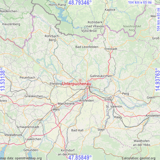
Unterpuchenau GPS coordinates[2]
48° 19' 41.232" North, 14° 14' 4.2" East
| Map corner | latitude | longitude |
|---|---|---|
| Upper-left | 48.79346°, | 13.53138° |
| Center: | 48.32812°, | 14.2345° |
| Lower-right: | 47.85849°, | 14.93763° |
| Map W x H: | 104×104 km | = 64.6×64.6mi |
| max Lat: | 48.98333° ⇑12.9% North |
| Unterpuchenau: | 48.32812° |
| min Lat: | ⇓87.1% South 46.48841° |
| min Long | Unterpuchenau | max Long |
| 9.57802° | 14.2345° | 17.1° |
| W 40.4%⇐ | ⇒59.6% E |
Elevation
Elevation of Unterpuchenau is 483 m = 1585 ft, and this is 22.5 m = 74 ft below average elevation for this country.
| Max E: |
2140 m = 7021 ft | 45.3% |
| Avg. | 505.5 m = 1658 ft | |
| Unterpuchenau | 483 m = 1585 ft | |
Min E: |
118 m = 387 ft | 54.7% |
See also: Austria elevation on elevation.city.
Geographical zone
Unterpuchenau is located in North temperate zone (between Tropic of Cancer and the Arctic Circle). Distance of this North polar circle is 2027.6 km =1259.9 mi to North.| Distance of | km | miles | from Unterpuchenau |
|---|---|---|---|
| North Pole | 4633.5 | 2879.1 | to North |
| Arctic Circle | 2027.6 | 1259.9 | to North |
| Tropic Cancer | 2767.7 | 1719.8 | to South |
| Equator | 5373.6 | 3339 | to South |


Nearby cities:
15 places around Unterpuchenau: (largest is in red/bold)
• Altlichtenberg
4 km =2.5 mi,  26°
26°
• Berg
4.1 km =2.5 mi,  165°
165°
• Bergham
5.2 km =3.2 mi,  182°
182°
• Dörnbach
5.6 km =3.5 mi,  203°
203°
• Dürnberg
2.3 km =1.4 mi,  293°
293°
• Edramsberg
4.8 km =3 mi,  248°
248°
• Leonding
5.6 km =3.5 mi, 165°
• Linz
4.5 km =2.8 mi,  122°
122°
• Mühlbach
4.4 km =2.7 mi,  233°
233°
• Niederottensheim
3.8 km =2.4 mi, 288°
• Ottensheim
4.5 km =2.8 mi,  276°
276°
• Puchenau
1.8 km =1.1 mi, 176°
• Rufling
5.7 km =3.5 mi,  193°
193°
• Türkstetten
4.9 km =3 mi,  339°
339°
• Zaubertal
3.1 km =1.9 mi,  151°
151°
Sources, notices
• [Note1] Compared only with cities in Austria existing in our database
• [Src1] Map data: © OpenStreetMap contributors (CC-BY-SA)
• [Src2] Other city data from geonames.org with taken over terms of usage.
• [Src3] Geographical zone / Annual Mean Temperature by Robert A. Rohde @ Wikipedia
