Katsch an der Mur geodata
Katsch an der Mur (Styria) is a populated place; located in Austria in Europe/Vienna (GMT+2) time zone. With population of 546 people, there are 2336 cities with bigger population in this country. Compared to other cities in Austria, 76.2% of cities are located further ↑North; 58.4% of cities are located further →East and 83.9% of cities have lower elevation than Katsch an der Mur. Note1
Administrative division(s):
- Level 1: Styria
- Level 2: Politischer Bezirk Murau
- Level 3: Teufenbach-Katsch


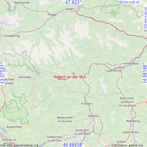
Katsch an der Mur GPS coordinates[2]
47° 8' 48.984" North, 14° 16' 41.988" East
| Map corner | latitude | longitude |
|---|---|---|
| Upper-left | 47.623°, | 13.57521° |
| Center: | 47.14694°, | 14.27833° |
| Lower-right: | 46.66658°, | 14.98146° |
| Map W x H: | 106.3×106.3 km | = 66.1×66.1mi |
| max Lat: | 48.98333° ⇑76.2% North |
| Katsch an der Mur: | 47.14694° |
| min Lat: | ⇓23.8% South 46.48841° |
| min Long | Katsch an der M | max Long |
| 9.57802° | 14.27833° | 17.1° |
| W 41.6%⇐ | ⇒58.4% E |
Elevation
Elevation of Katsch an der Mur is 781 m = 2562 ft, and this is 275.5 m = 904 ft above average elevation for this country.
| Max E: |
2140 m = 7021 ft | 16.1% |
| Katsch an der Mur | 781 m 2562 ft | |
| Avg. | 505.5 m = 1658 ft | |
Min E: |
118 m = 387 ft | 83.9% |
See also: Austria elevation on elevation.city.
Geographical zone
Katsch an der Mur is located in North temperate zone (between Tropic of Cancer and the Arctic Circle). Distance of this North polar circle is 2158.9 km =1341.5 mi to North.| Distance of | km | miles | from Katsch an der Mur |
|---|---|---|---|
| North Pole | 4764.8 | 2960.7 | to North |
| Arctic Circle | 2158.9 | 1341.5 | to North |
| Tropic Cancer | 2636.3 | 1638.1 | to South |
| Equator | 5242.2 | 3257.4 | to South |


Nearby cities:
15 places around Katsch an der Mur: (largest is in red/bold)
• Frojach
2.9 km =1.8 mi,  128°
128°
• Lind bei Scheifling
9.5 km =5.9 mi,  82°
82°
• Mariahof
10.6 km =6.6 mi,  119°
119°
• Murau
9.2 km =5.7 mi,  243°
243°
• Niederwölz
7.3 km =4.5 mi,  86°
86°
• Oberwölz Stadt
6 km =3.7 mi,  3°
3°
• Sankt Blasen
7.3 km =4.5 mi,  166°
166°
• Sankt Lambrecht
9.1 km =5.7 mi, 169°
• Sankt Lorenzen bei Scheifling
9.6 km =6 mi, 90°
• Sankt Peter am Kammersberg
8.4 km =5.2 mi,  302°
302°
• Scheifling
10.2 km =6.3 mi, 87°
• Teufenbach
6.4 km =4 mi,  108°
108°
• Triebendorf
4.8 km =3 mi,  225°
225°
• Vorstadt
6.3 km =3.9 mi, 2°
• Winklern bei Oberwölz
6.8 km =4.2 mi,  330°
330°
Sources, notices
• [Note1] Compared only with cities in Austria existing in our database
• [Src1] Map data: © OpenStreetMap contributors (CC-BY-SA)
• [Src2] Other city data from geonames.org with taken over terms of usage.
• [Src3] Geographical zone / Annual Mean Temperature by Robert A. Rohde @ Wikipedia
