Pfaffendorf geodata
Pfaffendorf (Styria) is a populated place; located in Austria in Europe/Vienna (GMT+2) time zone. With population of 510 people, there are 2471 cities with bigger population in this country. Compared to other cities in Austria, 74.2% of cities are located further ↑North; 50.2% of cities are located further ←West and 77.4% of cities have lower elevation than Pfaffendorf. Note1


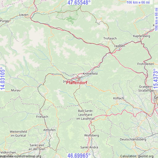
Pfaffendorf GPS coordinates[2]
47° 10' 46.992" North, 14° 44' 3.012" East
| Map corner | latitude | longitude |
|---|---|---|
| Upper-left | 47.65548°, | 14.03105° |
| Center: | 47.17972°, | 14.73417° |
| Lower-right: | 46.69965°, | 15.4373° |
| Map W x H: | 106.3×106.3 km | = 66.1×66.1mi |
| max Lat: | 48.98333° ⇑74.2% North |
| Pfaffendorf: | 47.17972° |
| min Lat: | ⇓25.8% South 46.48841° |
| min Long | Pfaffendorf | max Long |
| 9.57802° | 14.73417° | 17.1° |
| W 50.2%⇐ | ⇒49.8% E |
Elevation
Elevation of Pfaffendorf is 679 m = 2228 ft, and this is 173.5 m = 569 ft above average elevation for this country.
| Max E: |
2140 m = 7021 ft | 22.6% |
| Pfaffendorf | 679 m 2228 ft | |
| Avg. | 505.5 m = 1658 ft | |
Min E: |
118 m = 387 ft | 77.4% |
See also: Austria elevation on elevation.city.
Geographical zone
Pfaffendorf is located in North temperate zone (between Tropic of Cancer and the Arctic Circle). Distance of this North polar circle is 2155.3 km =1339.2 mi to North.| Distance of | km | miles | from Pfaffendorf |
|---|---|---|---|
| North Pole | 4761.2 | 2958.5 | to North |
| Arctic Circle | 2155.3 | 1339.2 | to North |
| Tropic Cancer | 2640 | 1640.4 | to South |
| Equator | 5245.9 | 3259.7 | to South |


Nearby cities:
15 places around Pfaffendorf: (largest is in red/bold)
• Dietersdorf
5.6 km =3.5 mi,  293°
293°
• Eppenstein
5.7 km =3.5 mi,  177°
177°
• Farrach
0.4 km =0.2 mi,  351°
351°
• Flatschach
4.3 km =2.7 mi,  16°
16°
• Fohnsdorf
4.5 km =2.8 mi,  300°
300°
• Großlobming
5 km =3.1 mi,  85°
85°
• Hetzendorf
3.9 km =2.4 mi,  275°
275°
• Judenburg
5.3 km =3.3 mi,  254°
254°
• Knittelfeld
7.5 km =4.7 mi,  56°
56°
• Landschach
7.8 km =4.8 mi,  73°
73°
• Neuzeltweg
1.3 km =0.8 mi, 15°
• Reifling
7.3 km =4.5 mi,  224°
224°
• Spielberg bei Knittelfeld
5.5 km =3.4 mi,  42°
42°
• Weißkirchen in Steiermark
3.3 km =2.1 mi, 181°
• Zeltweg
1.3 km =0.8 mi, 71°
Sources, notices
• [Note1] Compared only with cities in Austria existing in our database
• [Src1] Map data: © OpenStreetMap contributors (CC-BY-SA)
• [Src2] Other city data from geonames.org with taken over terms of usage.
• [Src3] Geographical zone / Annual Mean Temperature by Robert A. Rohde @ Wikipedia
