Reifling geodata
Reifling (Styria) is a seat of a third-order administrative division; located in Austria in Europe/Vienna (GMT+2) time zone. With population of 60 people, there are 2936 cities with bigger population in this country. Compared to other cities in Austria, 77.2% of cities are located further ↑North; 50.8% of cities are located further →East and 97.8% of cities have lower elevation than Reifling. Note1


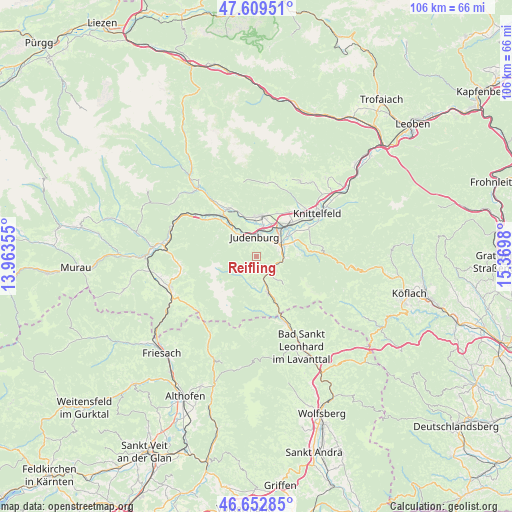
Reifling GPS coordinates[2]
47° 7' 59.988" North, 14° 40' 0.012" East
| Map corner | latitude | longitude |
|---|---|---|
| Upper-left | 47.60951°, | 13.96355° |
| Center: | 47.13333°, | 14.66667° |
| Lower-right: | 46.65285°, | 15.3698° |
| Map W x H: | 106.4×106.4 km | = 66.1×66.1mi |
| max Lat: | 48.98333° ⇑77.2% North |
| Reifling: | 47.13333° |
| min Lat: | ⇓22.8% South 46.48841° |
| min Long | Reifling | max Long |
| 9.57802° | 14.66667° | 17.1° |
| W 49.2%⇐ | ⇒50.8% E |
Elevation
Elevation of Reifling is 1187 m = 3894 ft, and this is 681.5 m = 2236 ft above average elevation for this country.
| Max E: |
2140 m = 7021 ft | 2.2% |
| Reifling | 1187 m 3894 ft | |
| Avg. | 505.5 m = 1658 ft | |
Min E: |
118 m = 387 ft | 97.8% |
See also: Austria elevation on elevation.city.
Geographical zone
Reifling is located in North temperate zone (between Tropic of Cancer and the Arctic Circle). Distance of this North polar circle is 2160.4 km =1342.4 mi to North.| Distance of | km | miles | from Reifling |
|---|---|---|---|
| North Pole | 4766.3 | 2961.6 | to North |
| Arctic Circle | 2160.4 | 1342.4 | to North |
| Tropic Cancer | 2634.8 | 1637.2 | to South |
| Equator | 5240.7 | 3256.4 | to South |


Nearby cities:
15 places around Reifling: (largest is in red/bold)
• Dietersdorf
7.4 km =4.6 mi,  0°
0°
• Eppenstein
5.4 km =3.4 mi,  95°
95°
• Farrach
7.5 km =4.7 mi,  42°
42°
• Flatschach
11.2 km =7 mi,  34°
34°
• Fohnsdorf
7.5 km =4.7 mi,  9°
9°
• Hetzendorf
5.7 km =3.5 mi, 12°
• Judenburg
3.7 km =2.3 mi, 0°
• Neuzeltweg
8.5 km =5.3 mi, 40°
• Obdach
7.5 km =4.7 mi,  170°
170°
• Oberweg
3.1 km =1.9 mi,  306°
306°
• Pfaffendorf
7.3 km =4.5 mi, 44°
• Pöls
11.2 km =7 mi,  325°
325°
• Sankt Peter ob Judenburg
8.3 km =5.2 mi, 312°
• Weißkirchen in Steiermark
5.4 km =3.4 mi,  69°
69°
• Zeltweg
8.4 km =5.2 mi,  48°
48°
Sources, notices
• [Note1] Compared only with cities in Austria existing in our database
• [Src1] Map data: © OpenStreetMap contributors (CC-BY-SA)
• [Src2] Other city data from geonames.org with taken over terms of usage.
• [Src3] Geographical zone / Annual Mean Temperature by Robert A. Rohde @ Wikipedia
