Boya geodata
Boya (Western Australia) is a section of populated place; located in Australia in Australia/Perth (GMT+8) time zone. With population of 633 people, there are 4481 cities with bigger population in this country. Compared to other cities in Australia, 66.3% of cities are located further ↓South; 91.7% of cities are located further →East and 77.1% of cities have lower elevation than Boya. Note1


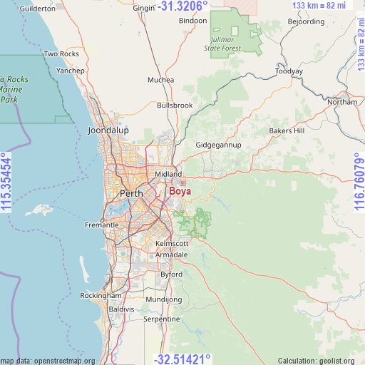
Boya GPS coordinates[2]
31° 55' 9.624" South, 116° 3' 27.576" East
| Map corner | latitude | longitude |
|---|---|---|
| Upper-left | -31.3206°, | 115.35454° |
| Center: | -31.91934°, | 116.05766° |
| Lower-right: | -32.51421°, | 116.76079° |
| Map W x H: | 132.7×132.7 km | = 82.5×82.5mi |
| max Lat: | -10.58257° ⇑33.7% North |
| Boya: | -31.91934° |
| min Lat: | ⇓66.3% South -43.31423° |
| min Long | Boya | max Long |
| 113.53327° | 116.05766° | 153.61246° |
| W 8.3%⇐ | ⇒91.7% E |
Elevation
Elevation of Boya is 149 m = 489 ft, and this is 27 m = 89 ft above average elevation for this country.
| Max E: |
1715 m = 5627 ft | 22.9% |
| Boya | 149 m 489 ft | |
| Avg. | 122 m = 400 ft | |
Min E: |
-2 m = -7 ft | 77.1% |
See also: Australia elevation on elevation.city.
Geographical zone
Boya is located in South temperate zone (between Tropic of Capricorn and the Antarctic Circle). Distance of this Southern Tropic circle is 943.2 km =586.1 mi to North.| Distance of | km | miles | from Boya |
|---|---|---|---|
| Equator | 3549.1 | 2205.3 | to North |
| Tropic Capricorn | 943.2 | 586.1 | to North |
| Antarctic Circle | 3852.1 | 2393.6 | to South |
| South Pole | 6458 | 4012.8 | to South |


Nearby cities:
15 places around Boya: (largest is in red/bold)
• Bellevue
3.5 km =2.2 mi,  305°
305°
• Darlington
2.2 km =1.4 mi,  89°
89°
• Glen Forrest
4.7 km =2.9 mi, 89°
• Gooseberry Hill
4 km =2.5 mi,  191°
191°
• Greenmount
2.2 km =1.4 mi,  339°
339°
• Hazelmere
4.3 km =2.7 mi,  272°
272°
• Helena Valley
1.7 km =1.1 mi, 269°
• High Wycombe
5.8 km =3.6 mi,  241°
241°
• Hovea
5.7 km =3.5 mi,  44°
44°
• Koongamia
2 km =1.2 mi, 314°
• Maida Vale
4.6 km =2.9 mi,  218°
218°
• Midland
5.6 km =3.5 mi, 307°
• Midvale
4.1 km =2.5 mi,  325°
325°
• Stratton
5.9 km =3.7 mi, 344°
• Swan View
4.1 km =2.5 mi,  349°
349°
Sources, notices
• [Note1] Compared only with cities in Australia existing in our database
• [Src1] Map data: © OpenStreetMap contributors (CC-BY-SA)
• [Src2] Other city data from geonames.org with taken over terms of usage.
• [Src3] Geographical zone / Annual Mean Temperature by Robert A. Rohde @ Wikipedia
