Shorncliffe geodata
Shorncliffe (Queensland) is a section of populated place; located in Australia in Australia/Brisbane (GMT+10) time zone. With population of 1,842 people, there are 3012 cities with bigger population in this country. Compared to other cities in Australia, 84.4% of cities are located further ↓South; 94.2% of cities are located further ←West and 96.8% of cities have higher elevation than Shorncliffe. Note1


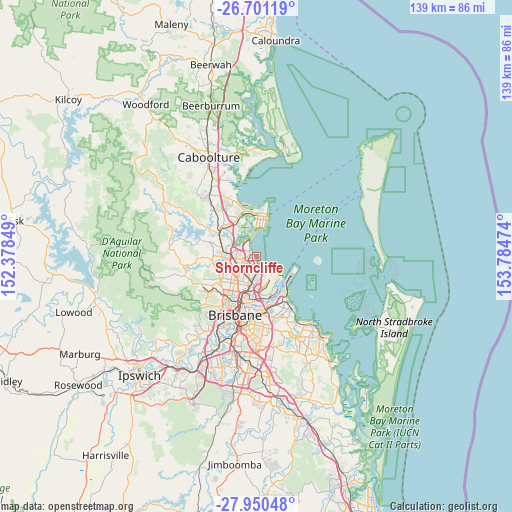
Shorncliffe GPS coordinates[2]
27° 19' 39.324" South, 153° 4' 53.796" East
| Map corner | latitude | longitude |
|---|---|---|
| Upper-left | -26.70119°, | 152.37849° |
| Center: | -27.32759°, | 153.08161° |
| Lower-right: | -27.95048°, | 153.78474° |
| Map W x H: | 138.9×138.9 km | = 86.3×86.3mi |
| max Lat: | -10.58257° ⇑15.6% North |
| Shorncliffe: | -27.32759° |
| min Lat: | ⇓84.4% South -43.31423° |
| min Long | Shorncliffe | max Long |
| 113.53327° | 153.08161° | 153.61246° |
| W 94.2%⇐ | ⇒5.8% E |
Elevation
Elevation of Shorncliffe is 5 m = 16 ft, and this is 117 m = 384 ft below average elevation for this country.
| Max E: |
1715 m = 5627 ft | 96.8% |
| Avg. | 122 m = 400 ft | |
| Shorncliffe | 5 m = 16 ft | |
Min E: |
-2 m = -7 ft | 3.2% |
See also: Australia elevation on elevation.city.
Geographical zone
Shorncliffe is located in South temperate zone (between Tropic of Capricorn and the Antarctic Circle). Distance of this Southern Tropic circle is 432.6 km =268.8 mi to North.| Distance of | km | miles | from Shorncliffe |
|---|---|---|---|
| Equator | 3038.5 | 1888 | to North |
| Tropic Capricorn | 432.6 | 268.8 | to North |
| Antarctic Circle | 4362.6 | 2710.8 | to South |
| South Pole | 6968.5 | 4330 | to South |


Nearby cities:
15 places around Shorncliffe: (largest is in red/bold)
• Bald Hills
7.3 km =4.5 mi,  275°
275°
• Banyo
6.1 km =3.8 mi,  182°
182°
• Boondall
3.5 km =2.2 mi,  215°
215°
• Bracken Ridge
5.1 km =3.2 mi, 283°
• Brighton
4.3 km =2.7 mi,  325°
325°
• Carseldine
6.2 km =3.9 mi,  249°
249°
• Deagon
2 km =1.2 mi,  269°
269°
• Fitzgibbon
5.3 km =3.3 mi,  255°
255°
• Geebung
6 km =3.7 mi,  214°
214°
• Griffin
7.5 km =4.7 mi, 326°
• Nudgee
4.6 km =2.9 mi, 176°
• Sandgate
1.3 km =0.8 mi,  297°
297°
• Taigum
4 km =2.5 mi, 245°
• Virginia
6.4 km =4 mi,  193°
193°
• Zillmere
4.8 km =3 mi,  229°
229°
Sources, notices
• [Note1] Compared only with cities in Australia existing in our database
• [Src1] Map data: © OpenStreetMap contributors (CC-BY-SA)
• [Src2] Other city data from geonames.org with taken over terms of usage.
• [Src3] Geographical zone / Annual Mean Temperature by Robert A. Rohde @ Wikipedia
