Barwon Heads geodata
Barwon Heads (Victoria) is a populated place; located in Australia in Australia/Melbourne (GMT+11) time zone. With population of 3,685 people, there are 1927 cities with bigger population in this country. Compared to other cities in Australia, 94.7% of cities are located further ↑North; 70.3% of cities are located further →East and 99.9% of cities have higher elevation than Barwon Heads. Note1


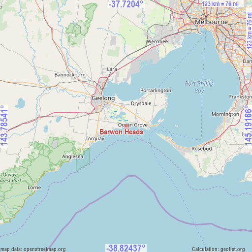
Barwon Heads GPS coordinates[2]
38° 16' 28.128" South, 144° 29' 18.708" East
| Map corner | latitude | longitude |
|---|---|---|
| Upper-left | -37.7204°, | 143.78541° |
| Center: | -38.27448°, | 144.48853° |
| Lower-right: | -38.82437°, | 145.19166° |
| Map W x H: | 122.7×122.7 km | = 76.2×76.2mi |
| max Lat: | -10.58257° ⇑94.7% North |
| Barwon Heads: | -38.27448° |
| min Lat: | ⇓5.3% South -43.31423° |
| min Long | Barwon Heads | max Long |
| 113.53327° | 144.48853° | 153.61246° |
| W 29.7%⇐ | ⇒70.3% E |
Elevation
Elevation of Barwon Heads is 1 m = 3 ft, and this is 121 m = 397 ft below average elevation for this country.
| Max E: |
1715 m = 5627 ft | 99.9% |
| Avg. | 122 m = 400 ft | |
| Barwon Heads | 1 m = 3 ft | |
Min E: |
-2 m = -7 ft | 0.1% |
See also: Australia elevation on elevation.city.
Geographical zone
Barwon Heads is located in South temperate zone (between Tropic of Capricorn and the Antarctic Circle). Distance of this Southern Tropic circle is 1649.8 km =1025.1 mi to North.| Distance of | km | miles | from Barwon Heads |
|---|---|---|---|
| Equator | 4255.7 | 2644.4 | to North |
| Tropic Capricorn | 1649.8 | 1025.1 | to North |
| Antarctic Circle | 3145.5 | 1954.5 | to South |
| South Pole | 5751.3 | 3573.7 | to South |


Nearby cities:
15 places around Barwon Heads: (largest is in red/bold)
• Armstrong Creek
11.1 km =6.9 mi,  295°
295°
• Breakwater
14.9 km =9.3 mi,  314°
314°
• Clifton Springs
14.3 km =8.9 mi,  23°
23°
• Connewarre
7.8 km =4.8 mi,  276°
276°
• Drysdale
13.4 km =8.3 mi,  32°
32°
• Grovedale
14.7 km =9.1 mi, 304°
• Leopold
9.6 km =6 mi,  349°
349°
• Moolap
11.2 km =7 mi,  334°
334°
• Mount Duneed
13.7 km =8.5 mi,  285°
285°
• Newcomb
14.6 km =9.1 mi, 325°
• Ocean Grove
3.3 km =2.1 mi,  55°
55°
• Point Lonsdale
10.7 km =6.6 mi,  94°
94°
• St Albans Park
12.8 km =8 mi,  318°
318°
• Wallington
5.7 km =3.5 mi, 20°
• Whittington
13.3 km =8.3 mi, 321°
Sources, notices
• [Note1] Compared only with cities in Australia existing in our database
• [Src1] Map data: © OpenStreetMap contributors (CC-BY-SA)
• [Src2] Other city data from geonames.org with taken over terms of usage.
• [Src3] Geographical zone / Annual Mean Temperature by Robert A. Rohde @ Wikipedia
