Mourilyan geodata
Mourilyan (Queensland) is a populated place; located in Australia in Australia/Brisbane (GMT+10) time zone. With population of 551 people, there are 4702 cities with bigger population in this country. Compared to other cities in Australia, 96.4% of cities are located further ↓South; 56.8% of cities are located further →East and 93.8% of cities have higher elevation than Mourilyan. Note1


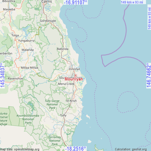
Mourilyan GPS coordinates[2]
17° 34' 57.288" South, 146° 2' 36.564" East
| Map corner | latitude | longitude |
|---|---|---|
| Upper-left | -16.91107°, | 145.34037° |
| Center: | -17.58258°, | 146.04349° |
| Lower-right: | -18.2516°, | 146.74662° |
| Map W x H: | 149.1×149.1 km | = 92.6×92.6mi |
| max Lat: | -10.58257° ⇑3.6% North |
| Mourilyan: | -17.58258° |
| min Lat: | ⇓96.4% South -43.31423° |
| min Long | Mourilyan | max Long |
| 113.53327° | 146.04349° | 153.61246° |
| W 43.2%⇐ | ⇒56.8% E |
Elevation
Elevation of Mourilyan is 7 m = 23 ft, and this is 115 m = 377 ft below average elevation for this country.
| Max E: |
1715 m = 5627 ft | 93.8% |
| Avg. | 122 m = 400 ft | |
| Mourilyan | 7 m = 23 ft | |
Min E: |
-2 m = -7 ft | 6.2% |
See also: Australia elevation on elevation.city.
Geographical zone
Mourilyan is located in South Torrid zone (between Equator and Tropic of Capricorn). Distance of this Southern Tropic circle is 650.9 km =404.5 mi to South.| Distance of | km | miles | from Mourilyan |
|---|---|---|---|
| Equator | 1955 | 1214.8 | to North |
| Tropic Capricorn | 650.9 | 404.5 | to South |
| Antarctic Circle | 5446.2 | 3384.1 | to South |
| South Pole | 8052.1 | 5003.3 | to South |


Nearby cities:
15 places around Mourilyan: (largest is in red/bold)
• Babinda
29.5 km =18.3 mi,  334°
334°
• Belvedere
8.9 km =5.5 mi,  318°
318°
• Cullinane
8.2 km =5.1 mi,  345°
345°
• East Innisfail
5.6 km =3.5 mi, 350°
• Goondi Bend
8.1 km =5 mi, 334°
• Goondi Hill
6.7 km =4.2 mi, 334°
• Innisfail
6.9 km =4.3 mi, 348°
• Innisfail Estate
7.1 km =4.4 mi,  1°
1°
• Kurrimine Beach
22.4 km =13.9 mi,  162°
162°
• Millaa Millaa
46.3 km =28.8 mi,  279°
279°
• Mission Beach
32.5 km =20.2 mi,  168°
168°
• South Mission Beach
41.1 km =25.5 mi, 174°
• Tully
41 km =25.5 mi,  198°
198°
• Wangan
3.9 km =2.4 mi, 278°
• Wongaling Beach
37.2 km =23.1 mi, 171°
Sources, notices
• [Note1] Compared only with cities in Australia existing in our database
• [Src1] Map data: © OpenStreetMap contributors (CC-BY-SA)
• [Src2] Other city data from geonames.org with taken over terms of usage.
• [Src3] Geographical zone / Annual Mean Temperature by Robert A. Rohde @ Wikipedia
