Moruya geodata
Moruya (New South Wales) is a populated place; located in Australia in Australia/Sydney (GMT+11) time zone. With population of 3,943 people, there are 1806 cities with bigger population in this country. Compared to other cities in Australia, 78.1% of cities are located further ↑North; 57.1% of cities are located further ←West and 98.1% of cities have higher elevation than Moruya. Note1


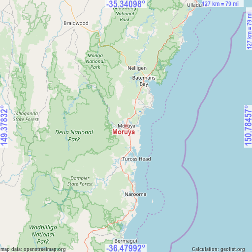
Moruya GPS coordinates[2]
35° 54' 45" South, 150° 4' 53.184" East
| Map corner | latitude | longitude |
|---|---|---|
| Upper-left | -35.34098°, | 149.37832° |
| Center: | -35.9125°, | 150.08144° |
| Lower-right: | -36.47992°, | 150.78457° |
| Map W x H: | 126.6×126.6 km | = 78.7×78.7mi |
| max Lat: | -10.58257° ⇑78.1% North |
| Moruya: | -35.9125° |
| min Lat: | ⇓21.9% South -43.31423° |
| min Long | Moruya | max Long |
| 113.53327° | 150.08144° | 153.61246° |
| W 57.1%⇐ | ⇒42.9% E |
Elevation
Elevation of Moruya is 4 m = 13 ft, and this is 118 m = 387 ft below average elevation for this country.
| Max E: |
1715 m = 5627 ft | 98.1% |
| Avg. | 122 m = 400 ft | |
| Moruya | 4 m = 13 ft | |
Min E: |
-2 m = -7 ft | 1.9% |
See also: Australia elevation on elevation.city.
Geographical zone
Moruya is located in South temperate zone (between Tropic of Capricorn and the Antarctic Circle). Distance of this Southern Tropic circle is 1387.2 km =862 mi to North.| Distance of | km | miles | from Moruya |
|---|---|---|---|
| Equator | 3993.1 | 2481.2 | to North |
| Tropic Capricorn | 1387.2 | 862 | to North |
| Antarctic Circle | 3408.1 | 2117.7 | to South |
| South Pole | 6014 | 3736.9 | to South |


Nearby cities:
15 places around Moruya: (largest is in red/bold)
• Batehaven
22.1 km =13.7 mi,  28°
28°
• Batemans Bay
24.4 km =15.2 mi,  20°
20°
• Bodalla
20.1 km =12.5 mi,  187°
187°
• Broulee
10.5 km =6.5 mi,  52°
52°
• Catalina
22.3 km =13.9 mi, 24°
• Denhams Beach
21.5 km =13.4 mi, 33°
• Lilli Pilli
20.1 km =12.5 mi,  41°
41°
• Malua Bay
18.7 km =11.6 mi, 45°
• Moruya Heads
6.5 km =4 mi,  95°
95°
• Mossy Point
12 km =7.5 mi, 47°
• North Batemans Bay
27 km =16.8 mi, 21°
• Sunshine Bay
21.8 km =13.5 mi, 31°
• Surfside
26.4 km =16.4 mi, 23°
• Tomakin
13.8 km =8.6 mi, 44°
• Tuross Head
16.3 km =10.1 mi,  163°
163°
Sources, notices
• [Note1] Compared only with cities in Australia existing in our database
• [Src1] Map data: © OpenStreetMap contributors (CC-BY-SA)
• [Src2] Other city data from geonames.org with taken over terms of usage.
• [Src3] Geographical zone / Annual Mean Temperature by Robert A. Rohde @ Wikipedia
