Kurnell geodata
Kurnell (New South Wales) is a section of populated place; located in Australia in Australia/Sydney (GMT+10) time zone. With population of 2,236 people, there are 2737 cities with bigger population in this country. Compared to other cities in Australia, 59.2% of cities are located further ↑North; 73.3% of cities are located further ←West and 96.8% of cities have higher elevation than Kurnell. Note1


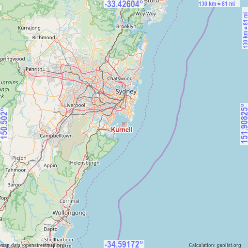
Kurnell GPS coordinates[2]
34° 0' 39.168" South, 151° 12' 18.432" East
| Map corner | latitude | longitude |
|---|---|---|
| Upper-left | -33.42604°, | 150.502° |
| Center: | -34.01088°, | 151.20512° |
| Lower-right: | -34.59172°, | 151.90825° |
| Map W x H: | 129.6×129.6 km | = 80.5×80.5mi |
| max Lat: | -10.58257° ⇑59.2% North |
| Kurnell: | -34.01088° |
| min Lat: | ⇓40.8% South -43.31423° |
| min Long | Kurnell | max Long |
| 113.53327° | 151.20512° | 153.61246° |
| W 73.3%⇐ | ⇒26.7% E |
Elevation
Elevation of Kurnell is 5 m = 16 ft, and this is 117 m = 384 ft below average elevation for this country.
| Max E: |
1715 m = 5627 ft | 96.8% |
| Avg. | 122 m = 400 ft | |
| Kurnell | 5 m = 16 ft | |
Min E: |
-2 m = -7 ft | 3.2% |
See also: Australia elevation on elevation.city.
Geographical zone
Kurnell is located in South temperate zone (between Tropic of Capricorn and the Antarctic Circle). Distance of this Southern Tropic circle is 1175.7 km =730.5 mi to North.| Distance of | km | miles | from Kurnell |
|---|---|---|---|
| Equator | 3781.7 | 2349.8 | to North |
| Tropic Capricorn | 1175.7 | 730.5 | to North |
| Antarctic Circle | 3619.5 | 2249.1 | to South |
| South Pole | 6225.4 | 3868.3 | to South |


Nearby cities:
15 places around Kurnell: (largest is in red/bold)
• Chifley
6 km =3.7 mi,  34°
34°
• Dolls Point
5.9 km =3.7 mi,  289°
289°
• Greenhills Beach
5.1 km =3.2 mi,  235°
235°
• Hillsdale
6.9 km =4.3 mi,  17°
17°
• Little Bay
5 km =3.1 mi,  44°
44°
• Malabar
6.7 km =4.2 mi, 36°
• Maroubra
7.3 km =4.5 mi, 21°
• Matraville
5.8 km =3.6 mi, 25°
• Monterey
6.8 km =4.2 mi,  309°
309°
• Phillip Bay
4.2 km =2.6 mi, 39°
• Ramsgate
6.8 km =4.2 mi,  297°
297°
• Ramsgate Beach
6.1 km =3.8 mi, 297°
• Sandringham
6.4 km =4 mi, 286°
• Sans Souci
7 km =4.3 mi, 289°
• Woolooware
6.9 km =4.3 mi, 235°
Sources, notices
• [Note1] Compared only with cities in Australia existing in our database
• [Src1] Map data: © OpenStreetMap contributors (CC-BY-SA)
• [Src2] Other city data from geonames.org with taken over terms of usage.
• [Src3] Geographical zone / Annual Mean Temperature by Robert A. Rohde @ Wikipedia
