Heathmont geodata
Heathmont (Victoria) is a section of populated place; located in Australia in Australia/Melbourne (GMT+11) time zone. With population of 9,517 people, there are 648 cities with bigger population in this country. Compared to other cities in Australia, 88.8% of cities are located further ↑North; 62% of cities are located further →East and 72.3% of cities have lower elevation than Heathmont. Note1


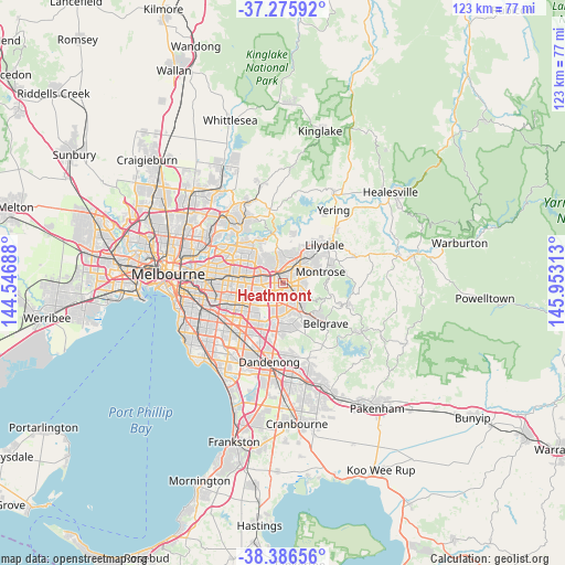
Heathmont GPS coordinates[2]
37° 49' 59.988" South, 145° 15' 0" East
| Map corner | latitude | longitude |
|---|---|---|
| Upper-left | -37.27592°, | 144.54688° |
| Center: | -37.83333°, | 145.25° |
| Lower-right: | -38.38656°, | 145.95313° |
| Map W x H: | 123.5×123.5 km | = 76.7×76.7mi |
| max Lat: | -10.58257° ⇑88.8% North |
| Heathmont: | -37.83333° |
| min Lat: | ⇓11.2% South -43.31423° |
| min Long | Heathmont | max Long |
| 113.53327° | 145.25° | 153.61246° |
| W 38%⇐ | ⇒62% E |
Elevation
Elevation of Heathmont is 114 m = 374 ft, and this is 8 m = 26 ft below average elevation for this country.
| Max E: |
1715 m = 5627 ft | 27.7% |
| Avg. | 122 m = 400 ft | |
| Heathmont | 114 m = 374 ft | |
Min E: |
-2 m = -7 ft | 72.3% |
See also: Australia elevation on elevation.city.
Geographical zone
Heathmont is located in South temperate zone (between Tropic of Capricorn and the Antarctic Circle). Distance of this Southern Tropic circle is 1600.8 km =994.7 mi to North.| Distance of | km | miles | from Heathmont |
|---|---|---|---|
| Equator | 4206.7 | 2613.9 | to North |
| Tropic Capricorn | 1600.8 | 994.7 | to North |
| Antarctic Circle | 3194.5 | 1985 | to South |
| South Pole | 5800.4 | 3604.2 | to South |


Nearby cities:
15 places around Heathmont: (largest is in red/bold)
• Bayswater
2.4 km =1.5 mi,  141°
141°
• Bayswater North
4.3 km =2.7 mi,  79°
79°
• Boronia
4.7 km =2.9 mi, 141°
• Croydon
4.7 km =2.9 mi,  38°
38°
• Croydon South
2.8 km =1.7 mi,  34°
34°
• Forest Hill
5.9 km =3.7 mi,  270°
270°
• Kilsyth South
6 km =3.7 mi, 75°
• Knoxfield
6.3 km =3.9 mi,  180°
180°
• Mitcham
4.8 km =3 mi,  292°
292°
• Ringwood
2.4 km =1.5 mi,  321°
321°
• Ringwood East
1.9 km =1.2 mi,  0°
0°
• Ringwood North
4 km =2.5 mi,  338°
338°
• The Basin
6.1 km =3.8 mi,  107°
107°
• Vermont
4.9 km =3 mi, 266°
• Wantirna
3.5 km =2.2 mi,  237°
237°
Sources, notices
• [Note1] Compared only with cities in Australia existing in our database
• [Src1] Map data: © OpenStreetMap contributors (CC-BY-SA)
• [Src2] Other city data from geonames.org with taken over terms of usage.
• [Src3] Geographical zone / Annual Mean Temperature by Robert A. Rohde @ Wikipedia
