Carrum geodata
Carrum (Victoria) is a section of populated place; located in Australia in Australia/Melbourne (GMT+11) time zone. With population of 3,885 people, there are 1833 cities with bigger population in this country. Compared to other cities in Australia, 92.6% of cities are located further ↑North; 63.7% of cities are located further →East and 95.5% of cities have higher elevation than Carrum. Note1


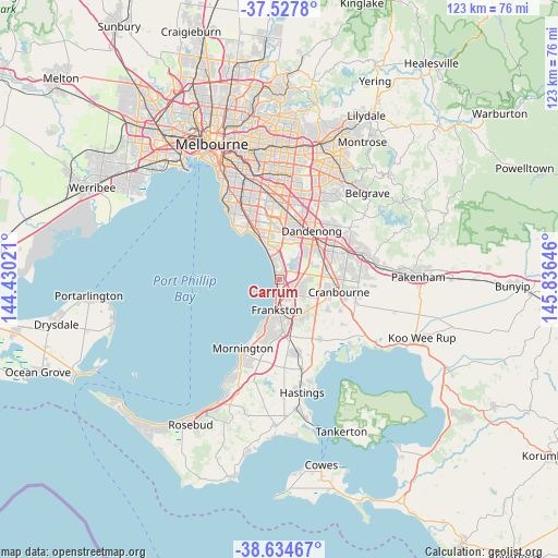
Carrum GPS coordinates[2]
38° 4' 59.988" South, 145° 7' 59.988" East
| Map corner | latitude | longitude |
|---|---|---|
| Upper-left | -37.5278°, | 144.43021° |
| Center: | -38.08333°, | 145.13333° |
| Lower-right: | -38.63467°, | 145.83646° |
| Map W x H: | 123.1×123.1 km | = 76.5×76.5mi |
| max Lat: | -10.58257° ⇑92.6% North |
| Carrum: | -38.08333° |
| min Lat: | ⇓7.4% South -43.31423° |
| min Long | Carrum | max Long |
| 113.53327° | 145.13333° | 153.61246° |
| W 36.3%⇐ | ⇒63.7% E |
Elevation
Elevation of Carrum is 6 m = 20 ft, and this is 116 m = 381 ft below average elevation for this country.
| Max E: |
1715 m = 5627 ft | 95.5% |
| Avg. | 122 m = 400 ft | |
| Carrum | 6 m = 20 ft | |
Min E: |
-2 m = -7 ft | 4.5% |
See also: Australia elevation on elevation.city.
Geographical zone
Carrum is located in South temperate zone (between Tropic of Capricorn and the Antarctic Circle). Distance of this Southern Tropic circle is 1628.6 km =1012 mi to North.| Distance of | km | miles | from Carrum |
|---|---|---|---|
| Equator | 4234.5 | 2631.2 | to North |
| Tropic Capricorn | 1628.6 | 1012 | to North |
| Antarctic Circle | 3166.7 | 1967.7 | to South |
| South Pole | 5772.6 | 3586.9 | to South |


Nearby cities:
15 places around Carrum: (largest is in red/bold)
• Aspendale
6.6 km =4.1 mi,  335°
335°
• Aspendale Gardens
6.9 km =4.3 mi,  348°
348°
• Bangholme
6.9 km =4.3 mi,  43°
43°
• Bonbeach
2.2 km =1.4 mi, 335°
• Carrum Downs
3.9 km =2.4 mi,  117°
117°
• Chelsea
4 km =2.5 mi, 338°
• Chelsea Heights
5.6 km =3.5 mi,  0°
0°
• Edithvale
5.5 km =3.4 mi, 338°
• Frankston
6.9 km =4.3 mi,  187°
187°
• Frankston East
5.6 km =3.5 mi,  180°
180°
• Frankston North
4.7 km =2.9 mi,  163°
163°
• Patterson Lakes
1.8 km =1.1 mi,  29°
29°
• Sandhurst
6.5 km =4 mi,  87°
87°
• Seaford
1.9 km =1.2 mi, 180°
• Waterways
7.6 km =4.7 mi,  358°
358°
Sources, notices
• [Note1] Compared only with cities in Australia existing in our database
• [Src1] Map data: © OpenStreetMap contributors (CC-BY-SA)
• [Src2] Other city data from geonames.org with taken over terms of usage.
• [Src3] Geographical zone / Annual Mean Temperature by Robert A. Rohde @ Wikipedia
