Currajong geodata
Currajong (Queensland) is a section of populated place; located in Australia in Australia/Brisbane (GMT+10) time zone. With population of 2,630 people, there are 2481 cities with bigger population in this country. Compared to other cities in Australia, 95.4% of cities are located further ↓South; 54.5% of cities are located further →East and 95.5% of cities have higher elevation than Currajong. Note1


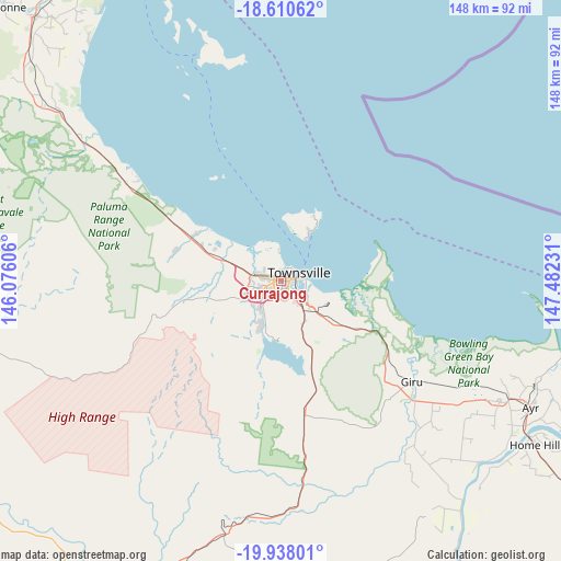
Currajong GPS coordinates[2]
19° 16' 32.376" South, 146° 46' 45.048" East
| Map corner | latitude | longitude |
|---|---|---|
| Upper-left | -18.61062°, | 146.07606° |
| Center: | -19.27566°, | 146.77918° |
| Lower-right: | -19.93801°, | 147.48231° |
| Map W x H: | 147.6×147.6 km | = 91.7×91.7mi |
| max Lat: | -10.58257° ⇑4.6% North |
| Currajong: | -19.27566° |
| min Lat: | ⇓95.4% South -43.31423° |
| min Long | Currajong | max Long |
| 113.53327° | 146.77918° | 153.61246° |
| W 45.5%⇐ | ⇒54.5% E |
Elevation
Elevation of Currajong is 6 m = 20 ft, and this is 116 m = 381 ft below average elevation for this country.
| Max E: |
1715 m = 5627 ft | 95.5% |
| Avg. | 122 m = 400 ft | |
| Currajong | 6 m = 20 ft | |
Min E: |
-2 m = -7 ft | 4.5% |
See also: Australia elevation on elevation.city.
Geographical zone
Currajong is located in South Torrid zone (between Equator and Tropic of Capricorn). Distance of this Southern Tropic circle is 462.7 km =287.5 mi to South.| Distance of | km | miles | from Currajong |
|---|---|---|---|
| Equator | 2143.3 | 1331.8 | to North |
| Tropic Capricorn | 462.7 | 287.5 | to South |
| Antarctic Circle | 5257.9 | 3267.1 | to South |
| South Pole | 7863.8 | 4886.3 | to South |


Nearby cities:
15 places around Currajong: (largest is in red/bold)
• Aitkenvale
3 km =1.9 mi,  197°
197°
• Castle Hill
3 km =1.9 mi,  49°
49°
• Garbutt
1.1 km =0.7 mi,  16°
16°
• Gulliver
1.4 km =0.9 mi,  189°
189°
• Heatley
3.1 km =1.9 mi,  238°
238°
• Hermit Park
2.6 km =1.6 mi,  120°
120°
• Hyde Park
1.8 km =1.1 mi,  94°
94°
• Mount Louisa
3 km =1.9 mi,  273°
273°
• Mundingburra
3 km =1.9 mi,  149°
149°
• Mysterton
2.1 km =1.3 mi, 122°
• Pimlico
1.1 km =0.7 mi,  125°
125°
• Rosslea
3.3 km =2.1 mi,  142°
142°
• Townsville
3 km =1.9 mi,  69°
69°
• Vincent
1.8 km =1.1 mi, 240°
• West End
1.8 km =1.1 mi,  57°
57°
Sources, notices
• [Note1] Compared only with cities in Australia existing in our database
• [Src1] Map data: © OpenStreetMap contributors (CC-BY-SA)
• [Src2] Other city data from geonames.org with taken over terms of usage.
• [Src3] Geographical zone / Annual Mean Temperature by Robert A. Rohde @ Wikipedia
