Tranmere geodata
Tranmere (Tasmania) is a section of populated place; located in Australia in Australia/Hobart (GMT+11) time zone. With population of 1,639 people, there are 3147 cities with bigger population in this country. Compared to other cities in Australia, 99.6% of cities are located further ↑North; 50.2% of cities are located further →East and 56.9% of cities have lower elevation than Tranmere. Note1


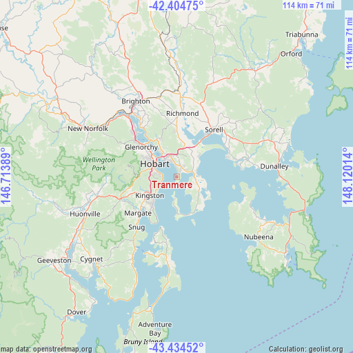
Tranmere GPS coordinates[2]
42° 55' 18.444" South, 147° 25' 1.236" East
| Map corner | latitude | longitude |
|---|---|---|
| Upper-left | -42.40475°, | 146.71389° |
| Center: | -42.92179°, | 147.41701° |
| Lower-right: | -43.43452°, | 148.12014° |
| Map W x H: | 114.5×114.5 km | = 71.1×71.1mi |
| max Lat: | -10.58257° ⇑99.6% North |
| Tranmere: | -42.92179° |
| min Lat: | ⇓0.4% South -43.31423° |
| min Long | Tranmere | max Long |
| 113.53327° | 147.41701° | 153.61246° |
| W 49.8%⇐ | ⇒50.2% E |
Elevation
Elevation of Tranmere is 57 m = 187 ft, and this is 65 m = 213 ft below average elevation for this country.
| Max E: |
1715 m = 5627 ft | 43.1% |
| Avg. | 122 m = 400 ft | |
| Tranmere | 57 m = 187 ft | |
Min E: |
-2 m = -7 ft | 56.9% |
See also: Australia elevation on elevation.city.
Geographical zone
Tranmere is located in South temperate zone (between Tropic of Capricorn and the Antarctic Circle). Distance of this Southern Tropic circle is 2166.5 km =1346.2 mi to North.| Distance of | km | miles | from Tranmere |
|---|---|---|---|
| Equator | 4772.5 | 2965.5 | to North |
| Tropic Capricorn | 2166.5 | 1346.2 | to North |
| Antarctic Circle | 2628.7 | 1633.4 | to South |
| South Pole | 5234.6 | 3252.6 | to South |


Nearby cities:
15 places around Tranmere: (largest is in red/bold)
• Acton Park
7.3 km =4.5 mi,  49°
49°
• Battery Point
7.7 km =4.8 mi,  297°
297°
• Bellerive
6.4 km =4 mi,  323°
323°
• Clarendon Vale
4.2 km =2.6 mi,  31°
31°
• Howrah
3.9 km =2.4 mi,  346°
346°
• Lauderdale
5.8 km =3.6 mi,  81°
81°
• Montagu Bay
8 km =5 mi, 322°
• Mornington
6.7 km =4.2 mi, 346°
• Mount Nelson
7.8 km =4.8 mi,  270°
270°
• Oakdowns
3.9 km =2.4 mi, 54°
• Rokeby
3.7 km =2.3 mi, 45°
• Rosny
7.5 km =4.7 mi, 319°
• Sandford
6.9 km =4.3 mi,  100°
100°
• Taroona
6.2 km =3.9 mi,  245°
245°
• Warrane
7.9 km =4.9 mi,  339°
339°
Sources, notices
• [Note1] Compared only with cities in Australia existing in our database
• [Src1] Map data: © OpenStreetMap contributors (CC-BY-SA)
• [Src2] Other city data from geonames.org with taken over terms of usage.
• [Src3] Geographical zone / Annual Mean Temperature by Robert A. Rohde @ Wikipedia
