Queenscliff geodata
Queenscliff (New South Wales) is a section of populated place; located in Australia in Australia/Sydney (GMT+11) time zone. With population of 3,267 people, there are 2086 cities with bigger population in this country. Compared to other cities in Australia, 51.3% of cities are located further ↑North; 75.5% of cities are located further ←West and 54.5% of cities have higher elevation than Queenscliff. Note1


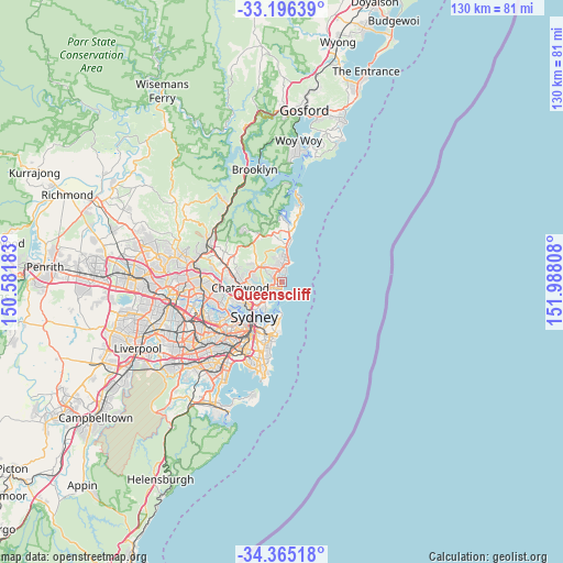
Queenscliff GPS coordinates[2]
33° 46' 58.008" South, 151° 17' 5.82" East
| Map corner | latitude | longitude |
|---|---|---|
| Upper-left | -33.19639°, | 150.58183° |
| Center: | -33.78278°, | 151.28495° |
| Lower-right: | -34.36518°, | 151.98808° |
| Map W x H: | 130×130 km | = 80.8×80.8mi |
| max Lat: | -10.58257° ⇑51.3% North |
| Queenscliff: | -33.78278° |
| min Lat: | ⇓48.7% South -43.31423° |
| min Long | Queenscliff | max Long |
| 113.53327° | 151.28495° | 153.61246° |
| W 75.5%⇐ | ⇒24.5% E |
Elevation
Elevation of Queenscliff is 39 m = 128 ft, and this is 83 m = 272 ft below average elevation for this country.
| Max E: |
1715 m = 5627 ft | 54.5% |
| Avg. | 122 m = 400 ft | |
| Queenscliff | 39 m = 128 ft | |
Min E: |
-2 m = -7 ft | 45.5% |
See also: Australia elevation on elevation.city.
Geographical zone
Queenscliff is located in South temperate zone (between Tropic of Capricorn and the Antarctic Circle). Distance of this Southern Tropic circle is 1150.4 km =714.8 mi to North.| Distance of | km | miles | from Queenscliff |
|---|---|---|---|
| Equator | 3756.3 | 2334.1 | to North |
| Tropic Capricorn | 1150.4 | 714.8 | to North |
| Antarctic Circle | 3644.9 | 2264.8 | to South |
| South Pole | 6250.8 | 3884.1 | to South |


Nearby cities:
15 places around Queenscliff: (largest is in red/bold)
• Allambie Heights
3.7 km =2.3 mi,  299°
299°
• Balgowlah
2.9 km =1.8 mi,  242°
242°
• Balgowlah Heights
3.4 km =2.1 mi,  218°
218°
• Brookvale
2.6 km =1.6 mi,  338°
338°
• Clontarf
3.8 km =2.4 mi,  228°
228°
• Curl Curl
1.6 km =1 mi,  13°
13°
• Dee Why
3.5 km =2.2 mi, 5°
• Fairlight
1.8 km =1.1 mi, 216°
• Freshwater
0.5 km =0.3 mi, 8°
• Manly
1.7 km =1.1 mi,  169°
169°
• Manly Vale
2.1 km =1.3 mi,  264°
264°
• Narraweena
3.2 km =2 mi,  345°
345°
• North Balgowlah
3.4 km =2.1 mi, 263°
• North Curl Curl
2.3 km =1.4 mi,  29°
29°
• North Manly
1.7 km =1.1 mi, 298°
Sources, notices
• [Note1] Compared only with cities in Australia existing in our database
• [Src1] Map data: © OpenStreetMap contributors (CC-BY-SA)
• [Src2] Other city data from geonames.org with taken over terms of usage.
• [Src3] Geographical zone / Annual Mean Temperature by Robert A. Rohde @ Wikipedia
