Warrenup geodata
Warrenup (Western Australia) is a populated place; located in Australia in Australia/Perth (GMT+8) time zone. With population of 644 people, there are 4460 cities with bigger population in this country. Compared to other cities in Australia, 70.7% of cities are located further ↑North; 90.1% of cities are located further →East and 53.5% of cities have lower elevation than Warrenup. Note1


Warrenup GPS coordinates[2]
34° 58' 31.944" South, 117° 50' 49.956" East
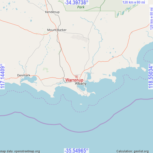
| Map corner | latitude | longitude |
|---|---|---|
| Upper-left | -34.39738°, | 117.14409° |
| Center: | -34.97554°, | 117.84721° |
| Lower-right: | -35.54965°, | 118.55034° |
| Map W x H: | 128.1×128.1 km | = 79.6×79.6mi |
| max Lat: | -10.58257° ⇑70.7% North |
| Warrenup: | -34.97554° |
| min Lat: | ⇓29.3% South -43.31423° |
| min Long | Warrenup | max Long |
| 113.53327° | 117.84721° | 153.61246° |
| W 9.9%⇐ | ⇒90.1% E |
Elevation
Elevation of Warrenup is 50 m = 164 ft, and this is 72 m = 236 ft below average elevation for this country.
| Max E: |
1715 m = 5627 ft | 46.5% |
| Avg. | 122 m = 400 ft | |
| Warrenup | 50 m = 164 ft | |
Min E: |
-2 m = -7 ft | 53.5% |
See also: Australia elevation on elevation.city.
Geographical zone
Warrenup is located in South temperate zone (between Tropic of Capricorn and the Antarctic Circle). Distance of this Southern Tropic circle is 1283 km =797.2 mi to North.| Distance of | km | miles | from Warrenup |
|---|---|---|---|
| Equator | 3888.9 | 2416.4 | to North |
| Tropic Capricorn | 1283 | 797.2 | to North |
| Antarctic Circle | 3512.3 | 2182.4 | to South |
| South Pole | 6118.1 | 3801.6 | to South |


Nearby cities:
15 places around Warrenup: (largest is in red/bold)
• Albany
6.6 km =4.1 mi,  149°
149°
• Albany city centre
6.5 km =4 mi, 148°
• Centennial Park
5.4 km =3.4 mi, 145°
• Gledhow
3.9 km =2.4 mi,  208°
208°
• Lockyer
3.5 km =2.2 mi,  162°
162°
• McKail
1.9 km =1.2 mi,  235°
235°
• Milpara
2.1 km =1.3 mi,  127°
127°
• Mira Mar
6.6 km =4.1 mi, 131°
• Mount Clarence
6.9 km =4.3 mi,  142°
142°
• Mount Melville
5.6 km =3.5 mi, 156°
• Orana
2.5 km =1.6 mi, 154°
• Robinson
6 km =3.7 mi,  191°
191°
• Spencer Park
5.8 km =3.6 mi,  124°
124°
• Willyung
4.6 km =2.9 mi,  39°
39°
• Yakamia
4.2 km =2.6 mi, 138°
Sources, notices
• [Note1] Compared only with cities in Australia existing in our database
• [Src1] Map data: © OpenStreetMap contributors (CC-BY-SA)
• [Src2] Other city data from geonames.org with taken over terms of usage.
• [Src3] Geographical zone / Annual Mean Temperature by Robert A. Rohde @ Wikipedia
