Honeywood geodata
Honeywood (Tasmania) is a section of populated place; located in Australia in Australia/Hobart (GMT+11) time zone. With population of 502 people, there are 4875 cities with bigger population in this country. Compared to other cities in Australia, 98.3% of cities are located further ↑North; 51.3% of cities are located further →East and 57.4% of cities have lower elevation than Honeywood. Note1


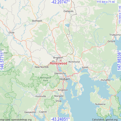
Honeywood GPS coordinates[2]
42° 43' 34.104" South, 147° 16' 48.828" East
| Map corner | latitude | longitude |
|---|---|---|
| Upper-left | -42.20747°, | 146.57711° |
| Center: | -42.72614°, | 147.28023° |
| Lower-right: | -43.24051°, | 147.98336° |
| Map W x H: | 114.9×114.9 km | = 71.4×71.4mi |
| max Lat: | -10.58257° ⇑98.3% North |
| Honeywood: | -42.72614° |
| min Lat: | ⇓1.7% South -43.31423° |
| min Long | Honeywood | max Long |
| 113.53327° | 147.28023° | 153.61246° |
| W 48.7%⇐ | ⇒51.3% E |
Elevation
Elevation of Honeywood is 58 m = 190 ft, and this is 64 m = 210 ft below average elevation for this country.
| Max E: |
1715 m = 5627 ft | 42.6% |
| Avg. | 122 m = 400 ft | |
| Honeywood | 58 m = 190 ft | |
Min E: |
-2 m = -7 ft | 57.4% |
See also: Australia elevation on elevation.city.
Geographical zone
Honeywood is located in South temperate zone (between Tropic of Capricorn and the Antarctic Circle). Distance of this Southern Tropic circle is 2144.8 km =1332.7 mi to North.| Distance of | km | miles | from Honeywood |
|---|---|---|---|
| Equator | 4750.7 | 2951.9 | to North |
| Tropic Capricorn | 2144.8 | 1332.7 | to North |
| Antarctic Circle | 2650.5 | 1646.9 | to South |
| South Pole | 5256.4 | 3266.2 | to South |


Nearby cities:
15 places around Honeywood: (largest is in red/bold)
• Austins Ferry
5.1 km =3.2 mi,  208°
208°
• Berriedale
10.4 km =6.5 mi,  193°
193°
• Bridgewater
4.5 km =2.8 mi,  253°
253°
• Brighton
4.2 km =2.6 mi,  317°
317°
• Chigwell
9.7 km =6 mi,  197°
197°
• Claremont
6.8 km =4.2 mi, 201°
• Dromedary
9.3 km =5.8 mi,  265°
265°
• Gagebrook
2.5 km =1.6 mi, 199°
• Granton
5.1 km =3.2 mi,  236°
236°
• Herdsmans Cove
3 km =1.9 mi, 204°
• Old Beach
5.8 km =3.6 mi, 191°
• Otago
9.3 km =5.8 mi,  170°
170°
• Pontville
4.4 km =2.7 mi,  347°
347°
• Risdon Vale
11.4 km =7.1 mi,  147°
147°
• Rosetta
10.8 km =6.7 mi, 192°
Sources, notices
• [Note1] Compared only with cities in Australia existing in our database
• [Src1] Map data: © OpenStreetMap contributors (CC-BY-SA)
• [Src2] Other city data from geonames.org with taken over terms of usage.
• [Src3] Geographical zone / Annual Mean Temperature by Robert A. Rohde @ Wikipedia
