Ingleside geodata
Ingleside (New South Wales) is a section of populated place; located in Australia in Australia/Sydney (GMT+11) time zone. With population of 935 people, there are 3922 cities with bigger population in this country. Compared to other cities in Australia, 51.5% of cities are located further ↓South; 75% of cities are located further ←West and 78.8% of cities have lower elevation than Ingleside. Note1


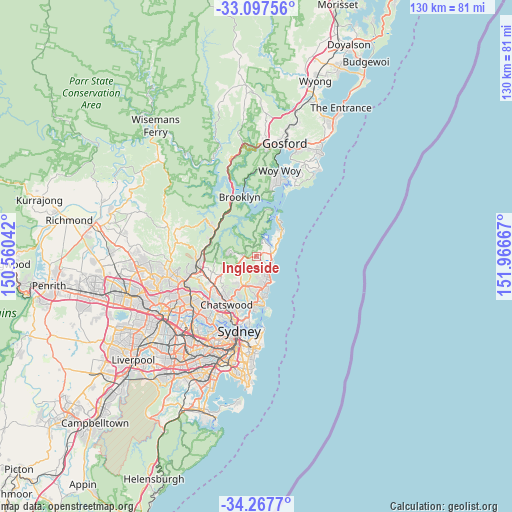
Ingleside GPS coordinates[2]
33° 41' 4.632" South, 151° 15' 48.744" East
| Map corner | latitude | longitude |
|---|---|---|
| Upper-left | -33.09756°, | 150.56042° |
| Center: | -33.68462°, | 151.26354° |
| Lower-right: | -34.2677°, | 151.96667° |
| Map W x H: | 130.1×130.1 km | = 80.8×80.8mi |
| max Lat: | -10.58257° ⇑48.5% North |
| Ingleside: | -33.68462° |
| min Lat: | ⇓51.5% South -43.31423° |
| min Long | Ingleside | max Long |
| 113.53327° | 151.26354° | 153.61246° |
| W 75%⇐ | ⇒25% E |
Elevation
Elevation of Ingleside is 165 m = 541 ft, and this is 43 m = 141 ft above average elevation for this country.
| Max E: |
1715 m = 5627 ft | 21.2% |
| Ingleside | 165 m 541 ft | |
| Avg. | 122 m = 400 ft | |
Min E: |
-2 m = -7 ft | 78.8% |
See also: Australia elevation on elevation.city.
Geographical zone
Ingleside is located in South temperate zone (between Tropic of Capricorn and the Antarctic Circle). Distance of this Southern Tropic circle is 1139.5 km =708.1 mi to North.| Distance of | km | miles | from Ingleside |
|---|---|---|---|
| Equator | 3745.4 | 2327.3 | to North |
| Tropic Capricorn | 1139.5 | 708.1 | to North |
| Antarctic Circle | 3655.8 | 2271.6 | to South |
| South Pole | 6261.7 | 3890.8 | to South |


Nearby cities:
15 places around Ingleside: (largest is in red/bold)
• Bay View
4.3 km =2.7 mi,  49°
49°
• Bilgola Plateau
6.1 km =3.8 mi, 47°
• Church Point
4.8 km =3 mi,  22°
22°
• Collaroy
6.3 km =3.9 mi,  146°
146°
• Collaroy Plateau
5.5 km =3.4 mi, 152°
• Cromer
5.2 km =3.2 mi,  175°
175°
• Elanora Heights
2.4 km =1.5 mi,  141°
141°
• Mona Vale
3.7 km =2.3 mi,  77°
77°
• Narrabeen
4.4 km =2.7 mi, 135°
• Newport
5.6 km =3.5 mi,  56°
56°
• North Narrabeen
4.1 km =2.5 mi,  132°
132°
• Scotland Island
5.4 km =3.4 mi, 24°
• Terry Hills
2.8 km =1.7 mi,  272°
272°
• Warriewood
3 km =1.9 mi,  98°
98°
• Wheeler Heights
5.4 km =3.4 mi,  163°
163°
Sources, notices
• [Note1] Compared only with cities in Australia existing in our database
• [Src1] Map data: © OpenStreetMap contributors (CC-BY-SA)
• [Src2] Other city data from geonames.org with taken over terms of usage.
• [Src3] Geographical zone / Annual Mean Temperature by Robert A. Rohde @ Wikipedia
