Han Pijesak geodata
Han Pijesak (Srpska) is a seat of a second-order administrative division; located in Bosnia and Herzegovina in Europe/Sarajevo (GMT+2) time zone. With population of 4,206 people, there are 150 cities with bigger population in this country. Compared to other cities in Bosnia and Herzegovina, 67.5% of cities are located further ↑North; 91.3% of cities are located further ←West and 98.5% of cities have lower elevation than Han Pijesak. Note1


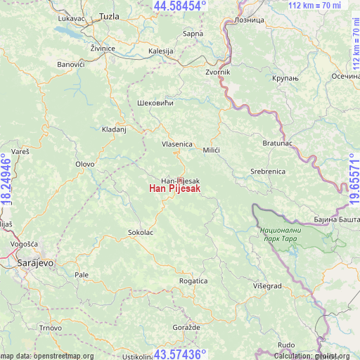
Han Pijesak GPS coordinates[2]
44° 4' 53.796" North, 18° 57' 9.288" East
| Map corner | latitude | longitude |
|---|---|---|
| Upper-left | 44.58454°, | 18.24946° |
| Center: | 44.08161°, | 18.95258° |
| Lower-right: | 43.57436°, | 19.65571° |
| Map W x H: | 112.3×112.3 km | = 69.8×69.8mi |
| max Lat: | 45.21956° ⇑67.5% North |
| Han Pijesak: | 44.08161° |
| min Lat: | ⇓32.5% South 42.71197° |
| min Long | Han Pijesak | max Long |
| 15.77806° | 18.95258° | 19.36719° |
| W 91.3%⇐ | ⇒8.7% E |
Elevation
Elevation of Han Pijesak is 1086 m = 3563 ft, and this is 726.5 m = 2384 ft above average elevation for this country.
| Max E: |
1175 m = 3855 ft | 1.5% |
| Han Pijesak | 1086 m 3563 ft | |
| Avg. | 359.5 m = 1179 ft | |
Min E: |
17 m = 56 ft | 98.5% |
See also: Bosnia and Herzegovina elevation on elevation.city.
Geographical zone
Han Pijesak is located in North temperate zone (between Tropic of Cancer and the Arctic Circle). Distance of this Northern Tropic circle is 2295.5 km =1426.4 mi to South.| Distance of | km | miles | from Han Pijesak |
|---|---|---|---|
| North Pole | 5105.6 | 3172.5 | to North |
| Arctic Circle | 2499.8 | 1553.3 | to North |
| Tropic Cancer | 2295.5 | 1426.4 | to South |
| Equator | 4901.4 | 3045.6 | to South |


Nearby cities:
15 places around Han Pijesak: (largest is in red/bold)
• Bratunac
32.3 km =20.1 mi,  69°
69°
• Kalesija
39.8 km =24.7 mi,  354°
354°
• Kladanj
26.3 km =16.3 mi,  307°
307°
• Milići
14.9 km =9.3 mi,  48°
48°
• Olovo
30.1 km =18.7 mi,  279°
279°
• Osmaci
35.7 km =22.2 mi,  355°
355°
• Prača
38.4 km =23.9 mi,  203°
203°
• Rogatica
31.7 km =19.7 mi,  172°
172°
• Sokolac
20 km =12.4 mi,  217°
217°
• Srebrenica
27.6 km =17.1 mi,  84°
84°
• Stupari
33.5 km =20.8 mi,  320°
320°
• Svojat
38.8 km =24.1 mi,  333°
333°
• Vlasenica
11.2 km =7 mi, 355°
• Zvornik
35.9 km =22.3 mi,  19°
19°
• Šekovići
25.4 km =15.8 mi,  342°
342°
Sources, notices
• [Note1] Compared only with cities in Bosnia and Herzegovina existing in our database
• [Src1] Map data: © OpenStreetMap contributors (CC-BY-SA)
• [Src2] Other city data from geonames.org with taken over terms of usage.
• [Src3] Geographical zone / Annual Mean Temperature by Robert A. Rohde @ Wikipedia
