Florenville geodata
Florenville (Wallonia) is a populated place; located in Belgium in Europe/Brussels (GMT+2) time zone. With population of 5,464 people, there are 439 cities with bigger population in this country. Compared to other cities in Belgium, 98.2% of cities are located further ↑North; 77.1% of cities are located further ←West and 94.8% of cities have lower elevation than Florenville. Note1
Administrative division(s):
- Level 1: Wallonia
- Level 2: Province du Luxembourg
- Level 3: Arrondissement de Virton
- Level 4: Florenville


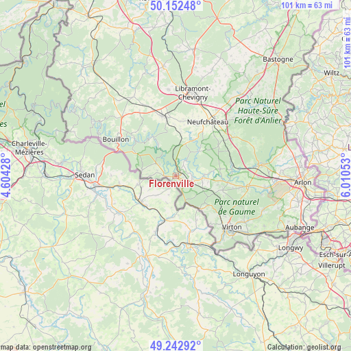
Florenville GPS coordinates[2]
49° 41' 59.388" North, 5° 18' 26.64" East
| Map corner | latitude | longitude |
|---|---|---|
| Upper-left | 50.15248°, | 4.60428° |
| Center: | 49.69983°, | 5.3074° |
| Lower-right: | 49.24292°, | 6.01053° |
| Map W x H: | 101.1×101.1 km | = 62.8×62.8mi |
| max Lat: | 51.46791° ⇑98.2% North |
| Florenville: | 49.69983° |
| min Lat: | ⇓1.8% South 49.53771° |
| min Long | Florenville | max Long |
| 2.59368° | 5.3074° | 6.25749° |
| W 77.1%⇐ | ⇒22.9% E |
Elevation
Elevation of Florenville is 342 m = 1122 ft, and this is 242.5 m = 796 ft above average elevation for this country.
| Max E: |
582 m = 1909 ft | 5.2% |
| Florenville | 342 m 1122 ft | |
| Avg. | 99.5 m = 326 ft | |
Min E: |
1 m = 3 ft | 94.8% |
See also: Belgium elevation on elevation.city.
Geographical zone
Florenville is located in North temperate zone (between Tropic of Cancer and the Arctic Circle). Distance of this North polar circle is 1875.1 km =1165.1 mi to North.| Distance of | km | miles | from Florenville |
|---|---|---|---|
| North Pole | 4481 | 2784.4 | to North |
| Arctic Circle | 1875.1 | 1165.1 | to North |
| Tropic Cancer | 2920.2 | 1814.5 | to South |
| Equator | 5526.1 | 3433.8 | to South |


Nearby cities:
15 places around Florenville: (largest is in red/bold)
• Bertrix
17.8 km =11.1 mi,  347°
347°
• Bouillon
20.2 km =12.6 mi,  301°
301°
• Chiny
4.9 km =3 mi,  29°
29°
• Habay-la-Vieille
22.6 km =14 mi,  83°
83°
• Herbeumont
10.4 km =6.5 mi,  330°
330°
• Léglise
19.9 km =12.4 mi,  55°
55°
• Meix-devant-Virton
16.3 km =10.1 mi,  130°
130°
• Neufchâteau
18.2 km =11.3 mi, 30°
• Paliseul
25.8 km =16 mi, 331°
• Rouvroy
22.3 km =13.9 mi,  143°
143°
• Saint-Léger
27 km =16.8 mi,  111°
111°
• Tintigny
14.9 km =9.3 mi,  97°
97°
• Vaux-sur-Sûre
30.5 km =19 mi,  39°
39°
• Virton
21.8 km =13.5 mi, 132°
• Étalle
21.3 km =13.2 mi, 97°
Sources, notices
• [Note1] Compared only with cities in Belgium existing in our database
• [Src1] Map data: © OpenStreetMap contributors (CC-BY-SA)
• [Src2] Other city data from geonames.org with taken over terms of usage.
• [Src3] Geographical zone / Annual Mean Temperature by Robert A. Rohde @ Wikipedia
