Varna geodata
Varna is a seat of a first-order administrative division; located in Bulgaria in Europe/Sofia (GMT+3) time zone. With population of 312,770 people, there are 2 cities with bigger population in this country. Compared to other cities in Bulgaria, 66.3% of cities are located further ↓South; 97% of cities are located further ←West and 87% of cities have higher elevation than Varna. Note1


Varna GPS coordinates[2]
43° 13' 0.012" North, 27° 55' 0.012" East
| Map corner | latitude | longitude |
|---|---|---|
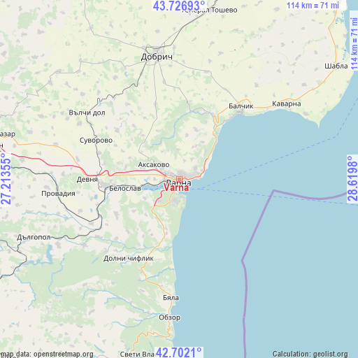
| Upper-left | 43.72693°, | 27.21355° |
| Center: | 43.21667°, | 27.91667° |
| Lower-right: | 42.7021°, | 28.6198° |
| Map W x H: | 114×113.9 km | = 70.8×70.8mi |
| max Lat: | 44.16214° ⇑33.7% North |
| Varna: | 43.21667° |
| min Lat: | ⇓66.3% South 41.32715° |
| min Long | Varna | max Long |
| 22.52139° | 27.91667° | 28.53429° |
| W 97%⇐ | ⇒3% E |
Elevation
Elevation of Varna is 54 m = 177 ft, and this is 262.6 m = 862 ft below average elevation for this country.
| Max E: |
1221 m = 4006 ft | 87% |
| Avg. | 316.6 m = 1039 ft | |
| Varna | 54 m = 177 ft | |
Min E: |
1 m = 3 ft | 13% |
See also: Varna elevation on elevation.city.
Geographical zone
Varna is located in North temperate zone (between Tropic of Cancer and the Arctic Circle). Distance of this Northern Tropic circle is 2199.3 km =1366.6 mi to South.| Distance of | km | miles | from Varna |
|---|---|---|---|
| North Pole | 5201.8 | 3232.2 | to North |
| Arctic Circle | 2595.9 | 1613 | to North |
| Tropic Cancer | 2199.3 | 1366.6 | to South |
| Equator | 4805.2 | 2985.8 | to South |


Nearby cities:
15 places around Varna: (largest is in red/bold)
• Aksakovo
8.9 km =5.5 mi,  299°
299°
• Asparuhovo
4.6 km =2.9 mi,  209°
209°
• Avren
23.1 km =14.4 mi,  241°
241°
• Balchik
30 km =18.6 mi,  40°
40°
• Beloslav
17.5 km =10.9 mi,  260°
260°
• Bliznatsi
17 km =10.6 mi,  193°
193°
• Byala
38.1 km =23.7 mi,  183°
183°
• Devnya
28.1 km =17.5 mi,  271°
271°
• Dobrich
39.5 km =24.5 mi,  350°
350°
• Dolni Chiflik
29.7 km =18.5 mi, 213°
• Kranevo
18 km =11.2 mi, 39°
• Provadia
39.4 km =24.5 mi, 264°
• Suvorovo
28.7 km =17.8 mi, 296°
• Valchidol
36 km =22.4 mi, 304°
• Zlatni Pyasatsi
12.7 km =7.9 mi,  53°
53°
Sources, notices
• [Note1] Compared only with cities in Bulgaria existing in our database
• [Src1] Map data: © OpenStreetMap contributors (CC-BY-SA)
• [Src2] Other city data from geonames.org with taken over terms of usage.
• [Src3] Geographical zone / Annual Mean Temperature by Robert A. Rohde @ Wikipedia
