Haskovo geodata
Haskovo is a seat of a first-order administrative division; located in Bulgaria in Europe/Sofia (GMT+3) time zone. With population of 79,699 people, there are 12 cities with bigger population in this country. Compared to other cities in Bulgaria, 86.7% of cities are located further ↑North; 58.7% of cities are located further ←West and 57.3% of cities have higher elevation than Haskovo. Note1


Haskovo GPS coordinates[2]
41° 56' 2.94" North, 25° 33' 20.052" East
| Map corner | latitude | longitude |
|---|---|---|
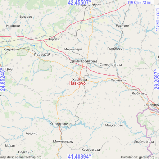
| Upper-left | 42.45507°, | 24.85245° |
| Center: | 41.93415°, | 25.55557° |
| Lower-right: | 41.40894°, | 26.2587° |
| Map W x H: | 116.3×116.3 km | = 72.3×72.3mi |
| max Lat: | 44.16214° ⇑86.7% North |
| Haskovo: | 41.93415° |
| min Lat: | ⇓13.3% South 41.32715° |
| min Long | Haskovo | max Long |
| 22.52139° | 25.55557° | 28.53429° |
| W 58.7%⇐ | ⇒41.3% E |
Elevation
Elevation of Haskovo is 195 m = 640 ft, and this is 121.6 m = 399 ft below average elevation for this country.
| Max E: |
1221 m = 4006 ft | 57.3% |
| Avg. | 316.6 m = 1039 ft | |
| Haskovo | 195 m = 640 ft | |
Min E: |
1 m = 3 ft | 42.7% |
See also: Haskovo elevation on elevation.city.
Geographical zone
Haskovo is located in North temperate zone (between Tropic of Cancer and the Arctic Circle). Distance of this Northern Tropic circle is 2056.7 km =1278 mi to South.| Distance of | km | miles | from Haskovo |
|---|---|---|---|
| North Pole | 5344.4 | 3320.9 | to North |
| Arctic Circle | 2738.5 | 1701.6 | to North |
| Tropic Cancer | 2056.7 | 1278 | to South |
| Equator | 4662.6 | 2897.2 | to South |


Nearby cities:
15 places around Haskovo: (largest is in red/bold)
• Bratya Daskalovi
49.4 km =30.7 mi,  325°
325°
• Chirpan
34.8 km =21.6 mi, 328°
• Dimitrovgrad
13.4 km =8.3 mi,  15°
15°
• Gabrovo
28.2 km =17.5 mi,  238°
238°
• Gŭlŭbovo
32.9 km =20.4 mi,  47°
47°
• Harmanli
28.5 km =17.7 mi,  90°
90°
• Kardzhali
35.3 km =21.9 mi,  206°
206°
• Lyubimets
45.1 km =28 mi,  104°
104°
• Madzharovo
42 km =26.1 mi,  142°
142°
• Mineralni Bani
17.1 km =10.6 mi,  263°
263°
• Opan
33.6 km =20.9 mi, 20°
• Parvomay
33.5 km =20.8 mi,  303°
303°
• Simeonovgrad
25.5 km =15.8 mi,  64°
64°
• Stambolovo
20.2 km =12.6 mi,  157°
157°
• Topolovo
46.1 km =28.6 mi,  265°
265°
Sources, notices
• [Note1] Compared only with cities in Bulgaria existing in our database
• [Src1] Map data: © OpenStreetMap contributors (CC-BY-SA)
• [Src2] Other city data from geonames.org with taken over terms of usage.
• [Src3] Geographical zone / Annual Mean Temperature by Robert A. Rohde @ Wikipedia
