Lyubimets geodata
Lyubimets (Haskovo) is a populated place; located in Bulgaria in Europe/Sofia (GMT+3) time zone. With population of 8,065 people, there are 96 cities with bigger population in this country. Compared to other cities in Bulgaria, 89.3% of cities are located further ↑North; 68.7% of cities are located further ←West and 84.7% of cities have higher elevation than Lyubimets. Note1


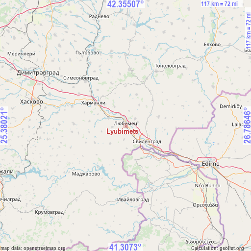
Lyubimets GPS coordinates[2]
41° 49' 59.988" North, 26° 4' 59.988" East
| Map corner | latitude | longitude |
|---|---|---|
| Upper-left | 42.35507°, | 25.38021° |
| Center: | 41.83333°, | 26.08333° |
| Lower-right: | 41.3073°, | 26.78646° |
| Map W x H: | 116.5×116.5 km | = 72.4×72.4mi |
| max Lat: | 44.16214° ⇑89.3% North |
| Lyubimets: | 41.83333° |
| min Lat: | ⇓10.7% South 41.32715° |
| min Long | Lyubimets | max Long |
| 22.52139° | 26.08333° | 28.53429° |
| W 68.7%⇐ | ⇒31.3% E |
Elevation
Elevation of Lyubimets is 68 m = 223 ft, and this is 248.6 m = 816 ft below average elevation for this country.
| Max E: |
1221 m = 4006 ft | 84.7% |
| Avg. | 316.6 m = 1039 ft | |
| Lyubimets | 68 m = 223 ft | |
Min E: |
1 m = 3 ft | 15.3% |
See also: Bulgaria elevation on elevation.city.
Geographical zone
Lyubimets is located in North temperate zone (between Tropic of Cancer and the Arctic Circle). Distance of this Northern Tropic circle is 2045.5 km =1271 mi to South.| Distance of | km | miles | from Lyubimets |
|---|---|---|---|
| North Pole | 5355.6 | 3327.8 | to North |
| Arctic Circle | 2749.7 | 1708.6 | to North |
| Tropic Cancer | 2045.5 | 1271 | to South |
| Equator | 4651.4 | 2890.2 | to South |


Nearby cities:
15 places around Lyubimets: (largest is in red/bold)
• Dimitrovgrad
46.7 km =29 mi,  301°
301°
• Elhovo
54.5 km =33.9 mi,  47°
47°
• Gŭlŭbovo
38.5 km =23.9 mi,  329°
329°
• Harmanli
18.8 km =11.7 mi,  306°
306°
• Haskovo
45.1 km =28 mi,  284°
284°
• Ivaylovgrad
34.3 km =21.3 mi,  174°
174°
• Krumovgrad
53.7 km =33.4 mi,  221°
221°
• Madzharovo
28.6 km =17.8 mi, 219°
• Mineralni Bani
61.4 km =38.2 mi, 278°
• Opan
53.1 km =33 mi,  323°
323°
• Radnevo
53.3 km =33.1 mi,  346°
346°
• Simeonovgrad
30.4 km =18.9 mi, 317°
• Stambolovo
36.7 km =22.8 mi,  258°
258°
• Svilengrad
12.2 km =7.6 mi,  127°
127°
• Topolovgrad
34.6 km =21.5 mi,  36°
36°
Sources, notices
• [Note1] Compared only with cities in Bulgaria existing in our database
• [Src1] Map data: © OpenStreetMap contributors (CC-BY-SA)
• [Src2] Other city data from geonames.org with taken over terms of usage.
• [Src3] Geographical zone / Annual Mean Temperature by Robert A. Rohde @ Wikipedia
