Olivença geodata
Olivença (Alagoas) is a populated place; located in Brazil in America/Maceio (GMT-3) time zone. With population of 2,848 people, there are 1995 cities with bigger population in this country. Compared to other cities in Brazil, 69.4% of cities are located further ↓South; 88.1% of cities are located further ←West and 58.6% of cities have higher elevation than Olivença. Note1


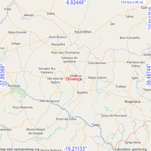
Olivença GPS coordinates[2]
9° 31' 6.996" South, 37° 11' 26.016" West
| Map corner | latitude | longitude |
|---|---|---|
| Upper-left | -8.82448°, | -37.89369° |
| Center: | -9.51861°, | -37.19056° |
| Lower-right: | -10.21133°, | -36.48744° |
| Map W x H: | 154.2×154.2 km | = 95.8×95.8mi |
| max Lat: | 2.81972° ⇑30.6% North |
| Olivença: | -9.51861° |
| min Lat: | ⇓69.4% South -33.69111° |
| min Long | Olivença | max Long |
| -72.89583° | -37.19056° | -32.41083° |
| W 88.1%⇐ | ⇒11.9% E |
Elevation
Elevation of Olivença is 226 m = 741 ft, and this is 154.9 m = 508 ft below average elevation for this country.
| Max E: |
1603 m = 5259 ft | 58.6% |
| Avg. | 380.9 m = 1250 ft | |
| Olivença | 226 m = 741 ft | |
Min E: |
0 m = 0 ft | 41.4% |
See also: Brazil elevation on elevation.city.
Geographical zone
Olivença is located in South Torrid zone (between Equator and Tropic of Capricorn). Distance of Equator is 1058.4 km =657.7 mi to North.| Distance of | km | miles | from Olivença |
|---|---|---|---|
| Equator | 1058.4 | 657.7 | to North |
| Tropic Capricorn | 1547.5 | 961.6 | to South |
| Antarctic Circle | 6342.8 | 3941.2 | to South |
| South Pole | 8948.7 | 5560.5 | to South |


Nearby cities:
15 places around Olivença: (largest is in red/bold)
• Batalha
19.1 km =11.9 mi,  157°
157°
• Cacimbinhas
25.6 km =15.9 mi,  59°
59°
• Dois Riachos
17.1 km =10.6 mi,  35°
35°
• Gararu
51.3 km =31.9 mi,  166°
166°
• Girau do Ponciano
56.8 km =35.3 mi,  135°
135°
• Lagoa da Canoa
60.5 km =37.6 mi,  124°
124°
• Major Isidoro
22.6 km =14 mi,  93°
93°
• Minador do Negrão
42.9 km =26.7 mi, 56°
• Porto da Folha
45.4 km =28.2 mi,  192°
192°
• Poço das Trincheiras
25.2 km =15.7 mi,  335°
335°
• Pão de Açúcar
37.2 km =23.1 mi,  226°
226°
• Santana do Ipanema
16.7 km =10.4 mi, 338°
• São José da Tapera
21.4 km =13.3 mi,  258°
258°
• Traipu
54.3 km =33.7 mi, 157°
• Águas Belas
45.9 km =28.5 mi,  9°
9°
Sources, notices
• [Note1] Compared only with cities in Brazil existing in our database
• [Src1] Map data: © OpenStreetMap contributors (CC-BY-SA)
• [Src2] Other city data from geonames.org with taken over terms of usage.
• [Src3] Geographical zone / Annual Mean Temperature by Robert A. Rohde @ Wikipedia
